Skyline Drive – July 13, 2017

We needed to make a trip to the Home Depot in Harrisonburg, and knowing it was going to be extremely hot and humid–not a good day to work outside–we decided to make a day trip of it and come back home via the Skyline Drive.

We took Rt. 33 East from Harrisonburg, heading towards the Blue Ridge Mountains.


While the views weren’t quite as spectacular as they usually are due to all of the haze and humidity, it was still nice to be up on the mountain.


Both the Skyline Drive and the Blue Ridge Parkway (further south) run north-south along the crest of the mountains.  Sometimes overlooks are on the left side of the road, and sometimes they’re on the right, so there are both east and west views.

East view at the Bacon Hollow Overlook:


Nice play of sunlight along the ridges of the mountains, west of the Skyline Drive.


Massanutten Mountain, near Harrisonburg, is quite the landmark….


We drove through Loft Mountain Campground to check out the various trailers and best campsites, then we walked up to the amphitheater. We could hear distant thunder, and we watched as a storm started moving across the Shenandoah Valley.


When we reached the Mormons River overlook (just above the Sugar Hollow reservoir), it was fascinating to see the rain–torrential rain!–coming down to the east.


The sound you’re hearing in the video clip isn’t thunder, but wind.  It was very breezy at the overlook, and the temperature dropped to 70 degrees.  Nice!


We were surprised to see fog swirling up between the ridges near the reservoir:


Just a little further south, the Beagle Gap overlook provides a good view of the Crozet area, as well as I-64.  I wondered how closely I could zoom in on the interstate with my camera.  Pretty close!  You can see the Crozet exit from both the eastbound and westbound lanes:


Soon we were at the southern end of the Skyline Drive, and leaving Shenandoah National Park.  If we’d continued straight, we would have been on the Blue Ridge Parkway.  We love having easy access to both of these scenic drives!


But back down the mountain we went on Rt. 250 East, returning to nearly 100-degree heat and high humidity.  At least we enjoyed spending a few hours on the beautiful Skyline Drive!

Posted in Adventures & Travels | Comments Off on Skyline Drive – July 13, 2017

Tarentum, PA – July 2017

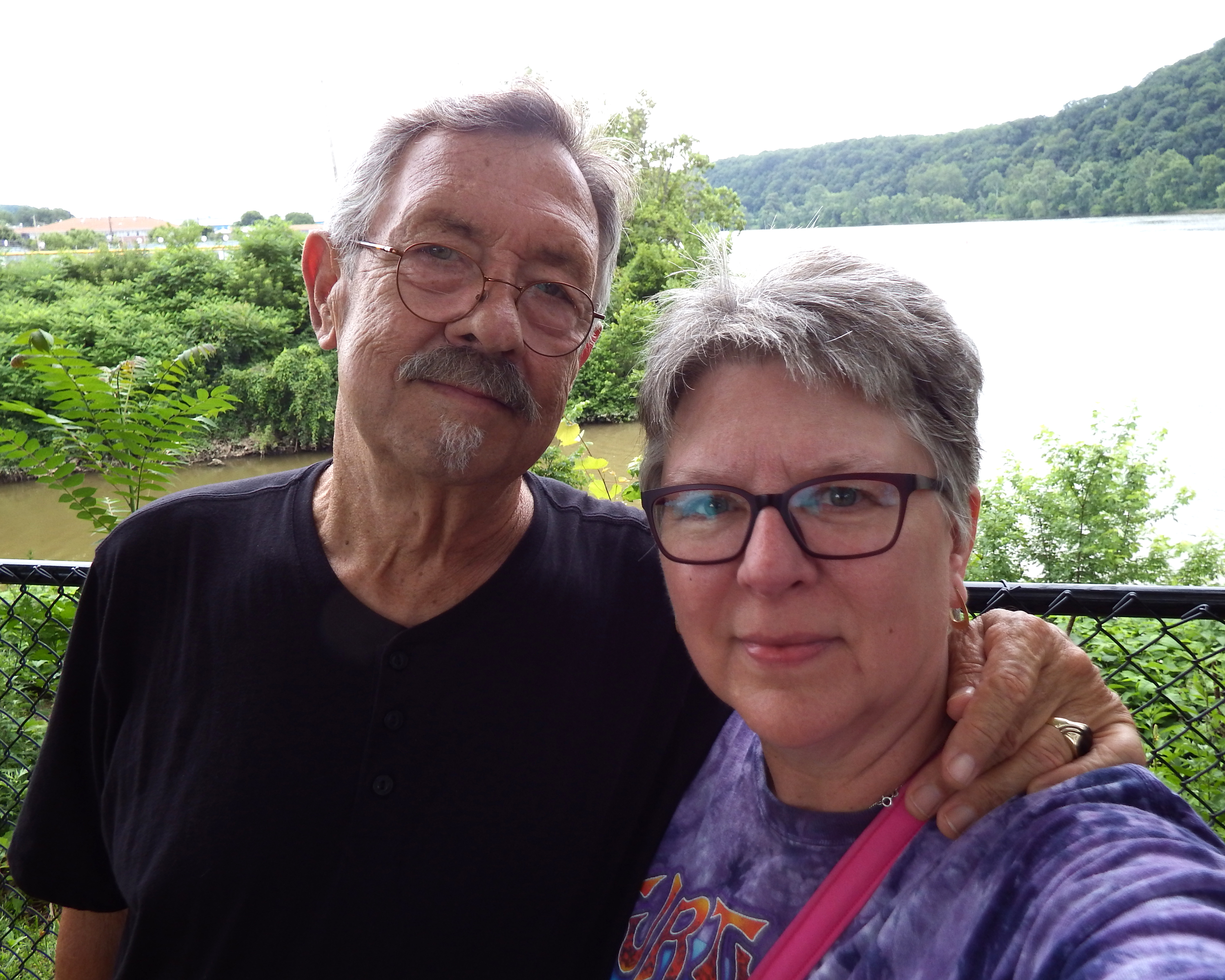
My paternal Barrett and Koontz grandparents were from Pennsylvania, and my father and his siblings were born there, in the town of Tarentum.  The family moved to Indiana in the mid-1930s, and although some of my cousins who live in Indiana remember visiting family and friends in Tarentum with my grandparents, I have no memory of ever having been there.   So when Wayne and I had an opportunity to make a quick trip to PA in July 2017, I was excited about doing some genealogy research, meeting–in person–a second cousin I’ve known “online” for years, and seeing the town where my dad was born.

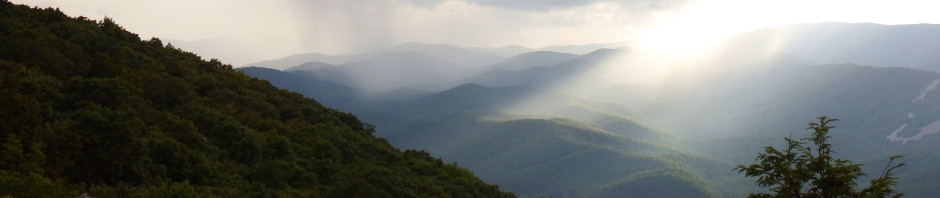
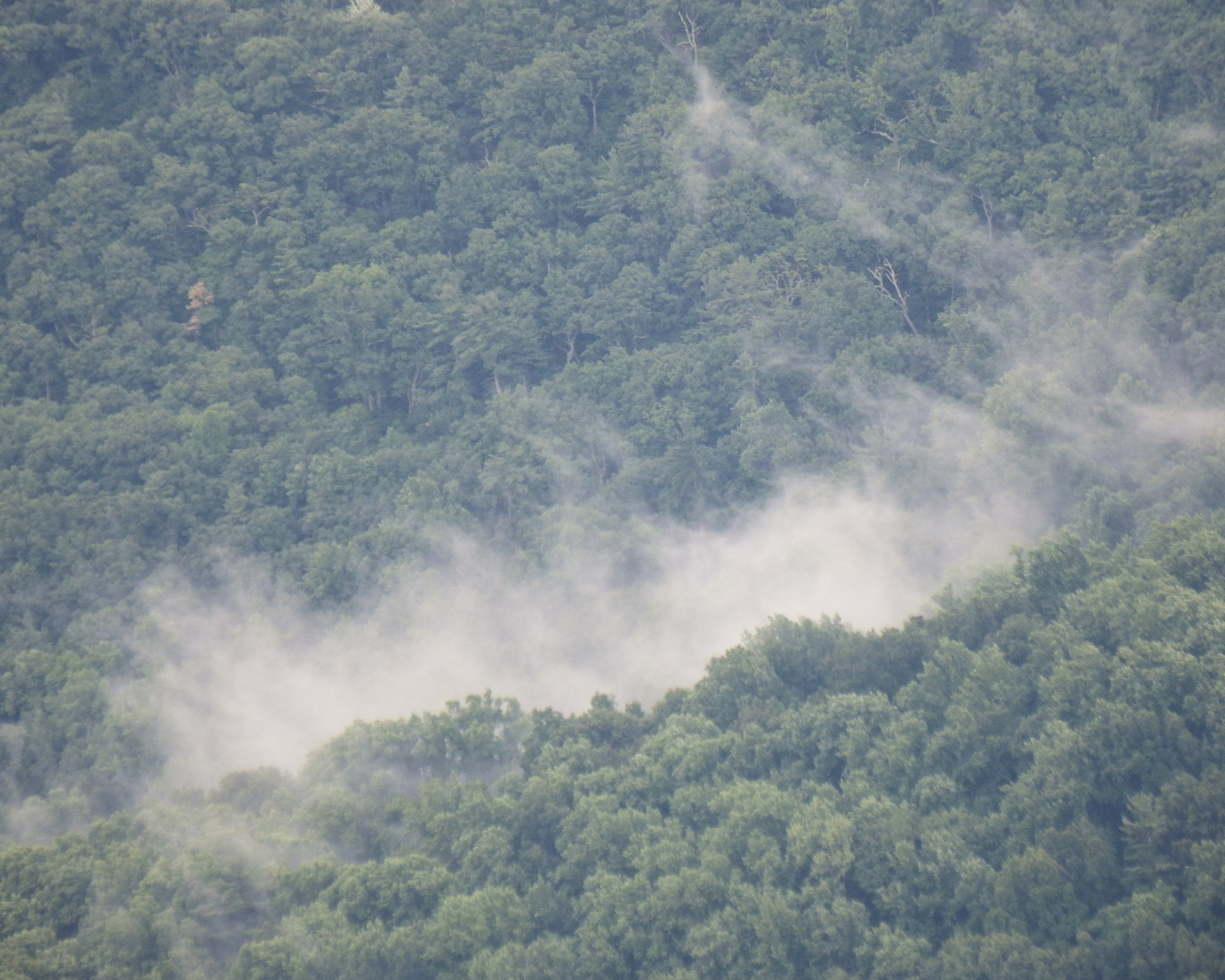
We left on Friday morning, July 7th, and drove north through the Shenandoah Valley on I-81. It was misty, with fog rolling over the mountains to our east, but by the time we got on Rt. 522 near Winchester, we had bright sunshine.  It had turned into a pretty day for a road trip!


Shortly after we crossed into West Virginia on 522, a Great Blue Heron flew over the road, directly in front of us.  We always pay attention to birds that we see on trips, so we made note of this one’s presence.

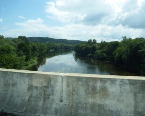
We crossed the Potomac River (which forms the boundary between West Virginia and Maryland), and within minutes we were in Pennsylvania, on I-70 West.


We were barely 5 miles into Pennsylvania when yet another Great Blue Heron flew directly in front of us, across the road.  Curious…

Near Breezewood, PA we got on I-76, which is better known as the Pennsylvania Turnpike. This toll road–advertised as “America’s First Superhighway”–took us the rest of the way to Tarentum.


Google Maps showed 299 miles from home to the motel just south of Tarentum where we had reservations, and–wow–it was exactly 299 miles!  Since it was early afternoon and we’d made pretty good time, we rested for a while before going out to explore.

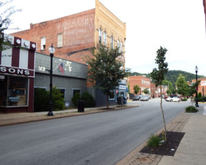
Later, as we drove around this small town on the banks of the Allegheny River, I was surprised by how hilly it is!  1st Avenue runs right along the river, and each parallel avenue (2nd, 3rd, 4th, etc.) is higher up the hill.  I guess when Grandma Barrett went “downtown,” she literally went down to the town!

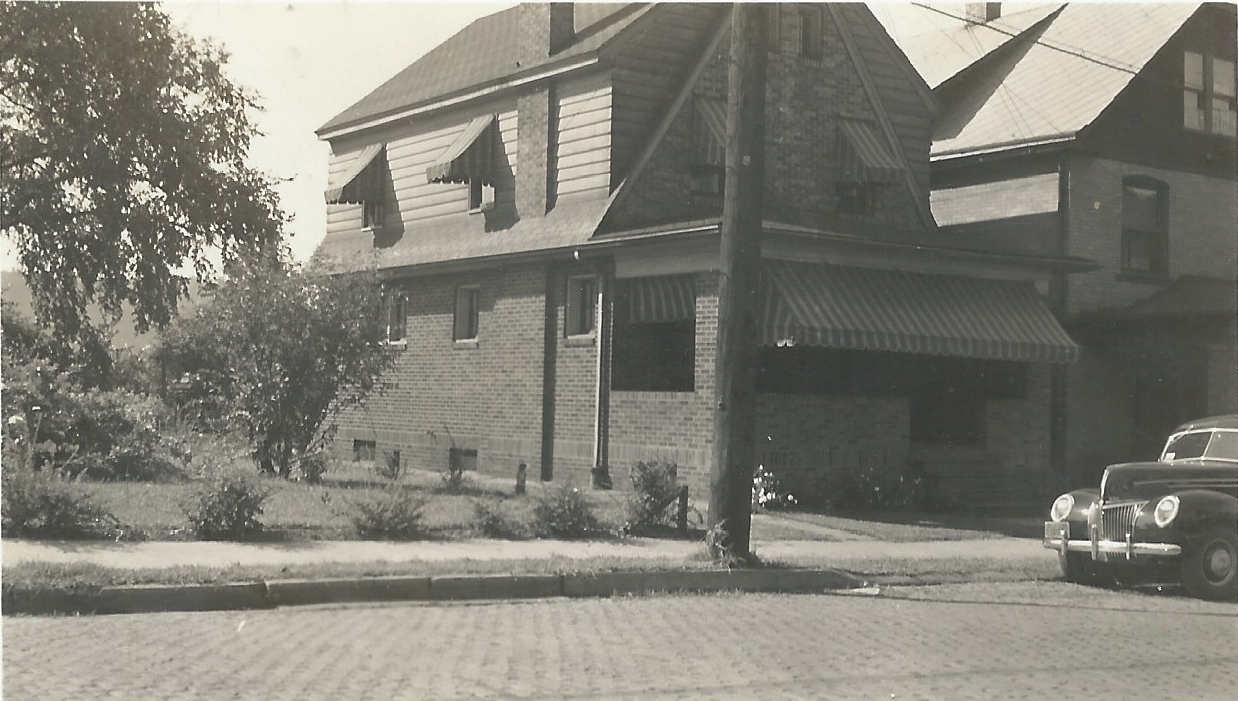
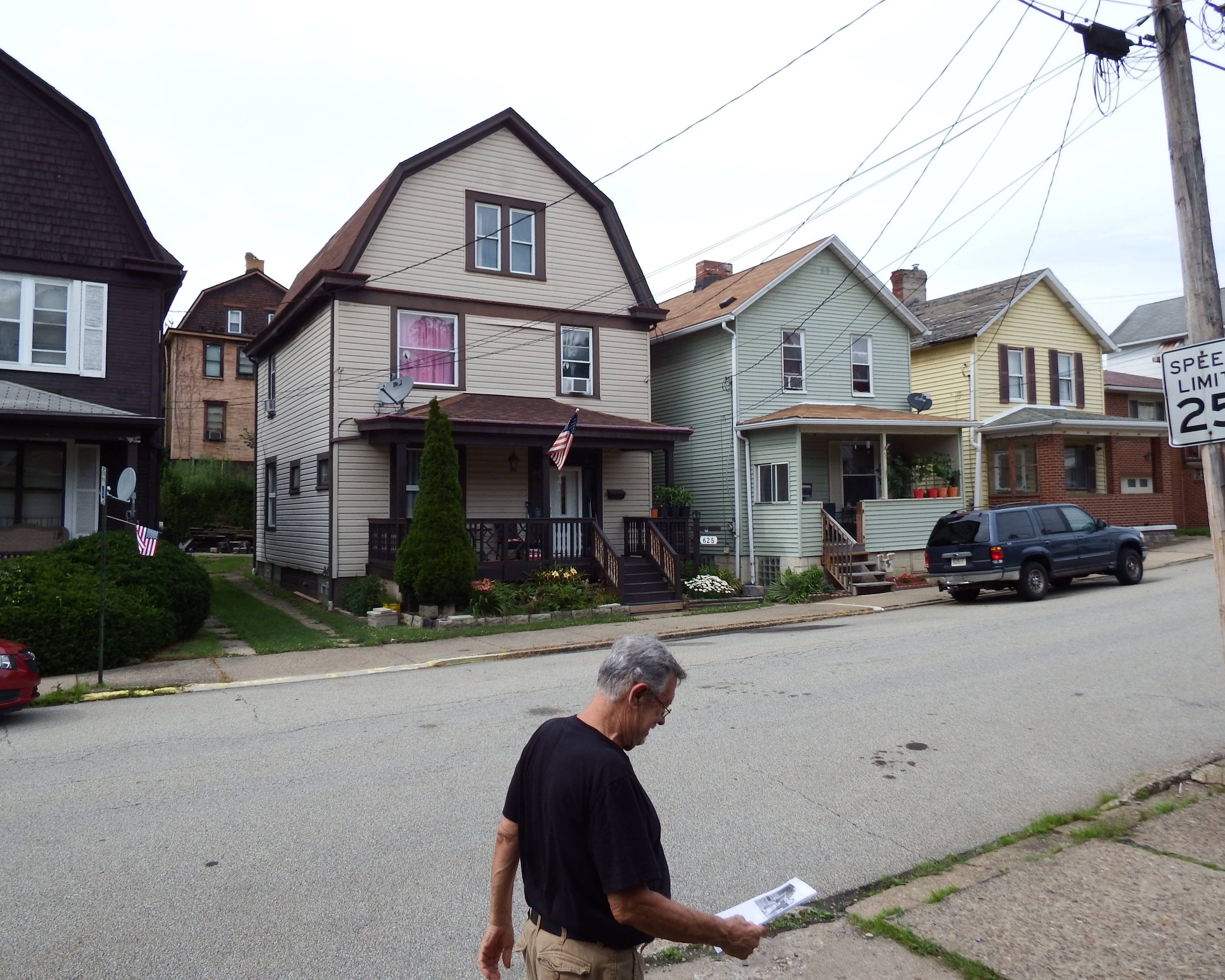
About a year ago, I’d identified the house where my dad had lived as a child by using old family pictures, census records, and Google Maps “street view” to confirm.  The shapes of the houses are very distinctive, and I felt sure I would be able to find it.

And it WAS easy to find!  I’d printed several of the old pictures to take with me on the trip, and being uncharacteristically bold, I grabbed the pictures and a notepad, walked up to the house, and knocked on the door….

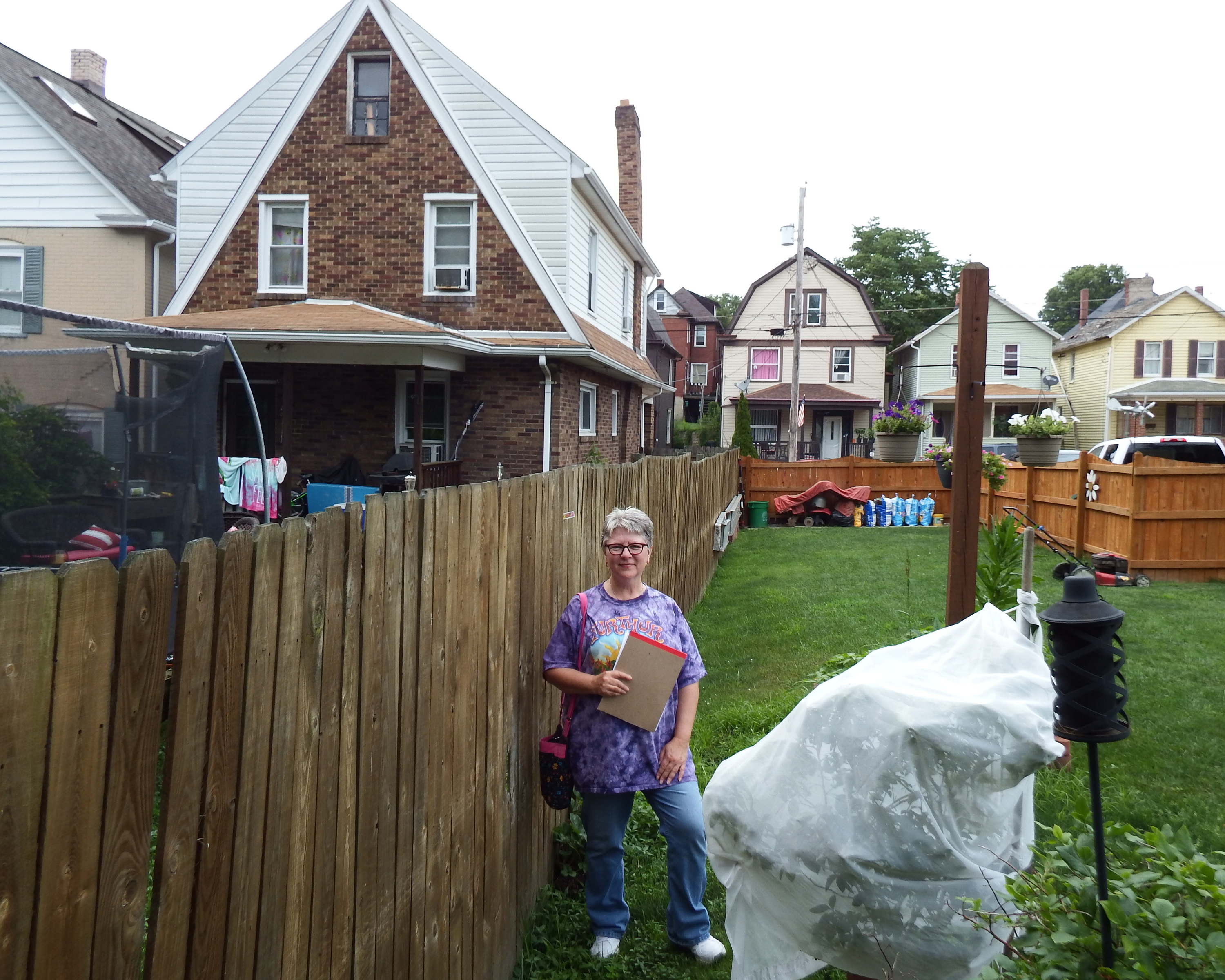
I got the attention of the resident dog inside, but his or her owners weren’t home.  I’d hoped to ask permission to take some pictures, but since there was no one to ask


We heard someone in the next yard mowing, so we walked over and got his attention.  We explained what we were doing, and he graciously allowed us to take some pictures of the back of the house from his yard.  I gave him my phone number and email address and asked him to please tell his neighbors to contact me if they had any concerns or questions–or if they wanted to see the pictures I have of their house from the 1930s when the Barrett family lived there.

But too cool–at least I was able to stand close to where my uncle, aunt, and dad were standing in this picture. <3


From what I can tell from census records, my grandmother, Hazel Koontz Barrett, grew up in Tarentum.  Her father, however, John Victor Koontz, was born in Staunton, Virginia in 1861.  Sometime after 1880 (when he last appeared in Staunton, VA census records), John Victor Koontz moved to Allegheny County and the Tarentum area.  In 1887, he married my great-grandmother, Lottie, in neighboring Armstrong County.

Lottie has became a source of genealogical confusion….  I’d always heard that her name was Lottie May Wolfe, daughter of Benton L. Wolfe and Marietta (also spelled “Mary Etta”) McGraw Wolfe of Armstrong County, PA.  That’s what’s on her death certificate, and that’s also what’s on her obituary. However, when Lottie married John V. Koontz at the age of 16, Marietta had to sign a document stating that she, as her mother, gave her permission to get married, but listed Lottie’s parents as Mark and Mary Erwin!  Erwin was also listed as Lottie’s maiden name on the delayed birth certificate for her son, John.

I’ve been able to find a Mary Erwin in the 1870 census in Armstrong County, but I haven’t found a Mark Erwin anywhere in the area.  Mary Erwin was living in the household of Charles Albertson, whose occupation was listed as “Supt. of Oil Well.”  I can’t prove that this is the right Mary Erwin (mother of Lottie), but it’s the only Mary Erwin I’ve found in the area around the time of Lottie’s birth.  And of course I haven’t ruled out the possibility that Marietta/Mary Etta McGraw and Mary Erwin were the same person, but I’ve found nothing to indicate that Marietta was first married to an Erwin….

Lottie May Erwin was born about a year before Benton L. Wolfe and Marietta (Mary Etta) McGraw were married, but whatever the history of her birth and parentage, she was most certainly raised as the Wolfe’s daughter.

Lottie and John Victor Koontz lived in several different houses in the Tarentum area, but by 1920, they were living in this house.


Their children (shown standing in front of the house) were Leonard, Hazel (my grandmother),  John, Eva, and Victor.

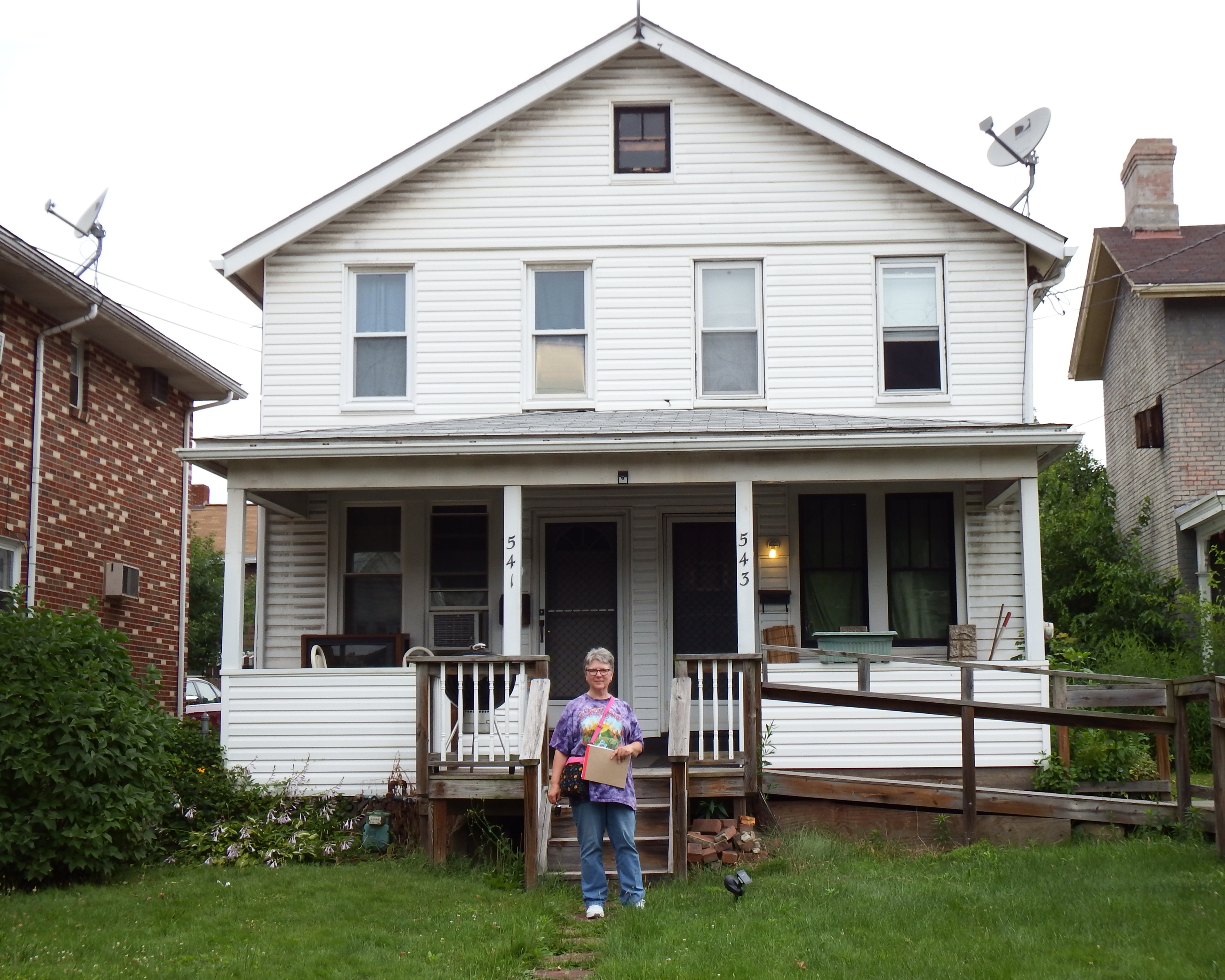
And so this was our NEXT destination in our exploration of Tarentum.  Once more, the house was easy to find, and I walked up and knocked on the door.  Actually, I knocked on both doors, since it’s a duplex, but no one was home.


When Eva Koontz married, she and her husband lived in one side of the duplex, and her parents lived in the other side.  Albert and Eva Koontz Allen continued to live there long after her parents had passed away.

My grandmother’s youngest brother, John Koontz, lived in Tarentum all of his life, in a house just one avenue up the hill.  He married and had two children, and his daughter–my 1st cousin 1x removed–still lives in the house she grew up in!  Despite writing at least a dozen letters to her over the last several years, sending copies of old pictures, sending pictures of me and my cousins (and kids, and parents, etc., etc.) and asking a ton of questions about our shared ancestry, she has never responded.  Ever. 🙁  We drove by her house a couple of times, but I didn’t want to push the issue by knocking on her door.   If I’d seen her on her porch, however, that would have been a different matter. 😉

From the Koontz house, we drove down to Riverview Park along the Allegheny.  This is a very pretty park, and the various memorials were still decorated from the 4th of July holiday.


The fence on the river-side of the park has lots of gates in it.  Most of the gates are padlocked closed, and down over the bank are docks and boats.  I’d never seen a set up like this before!  Some of the docks were pretty simple, but some, like the one on the left, were quite elaborate.


Before leaving the park, I stopped to read the names on the memorial for Tarentum men who died during WWI.  I’m sure my grandfather Barrett knew several of them….


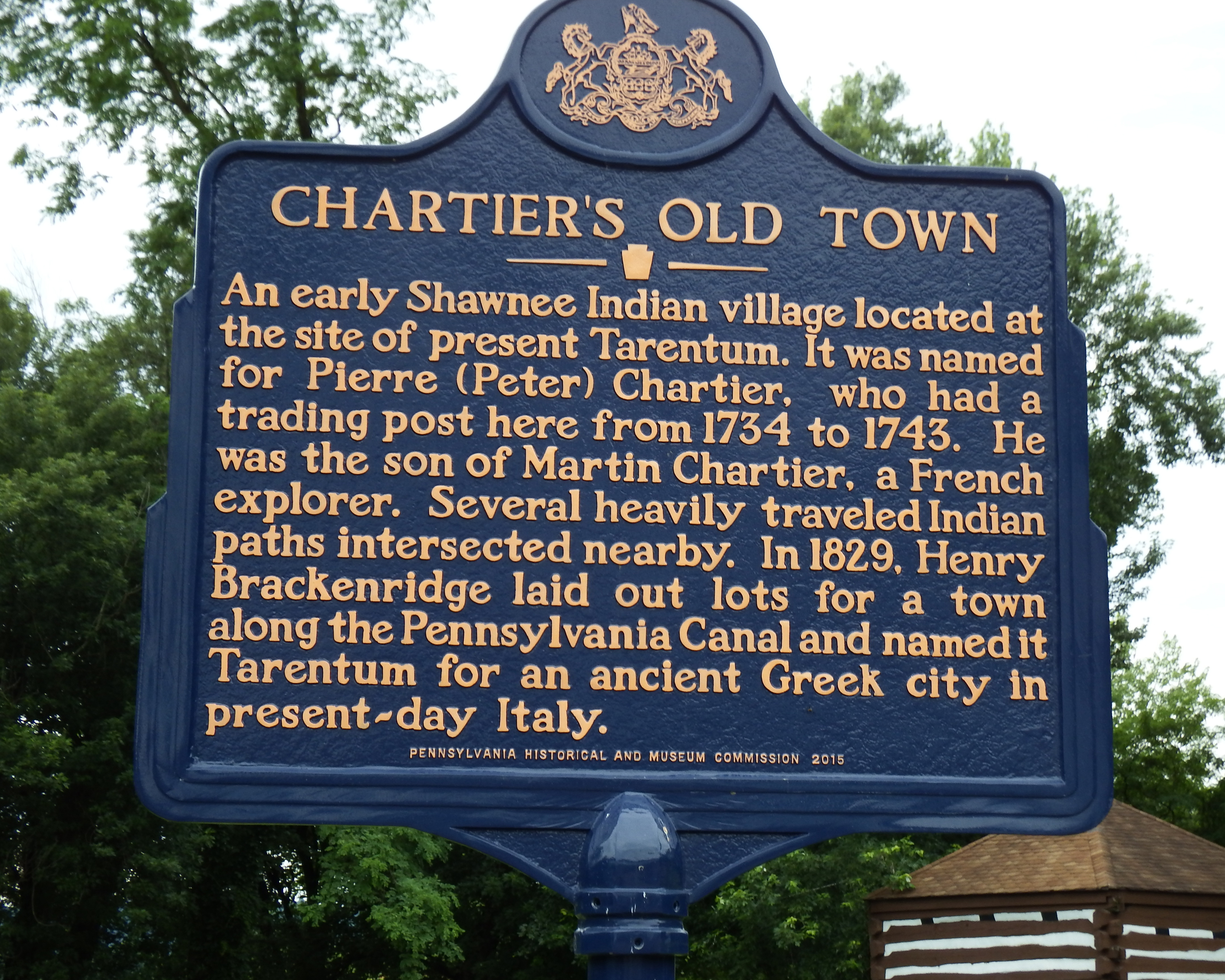
We continued to drive south on 1st Avenue and under the Tarentum bridge to Tarentum Point Park.  A sign at the end of the parking lot told the history of this area; I always wondered how the town got its name!


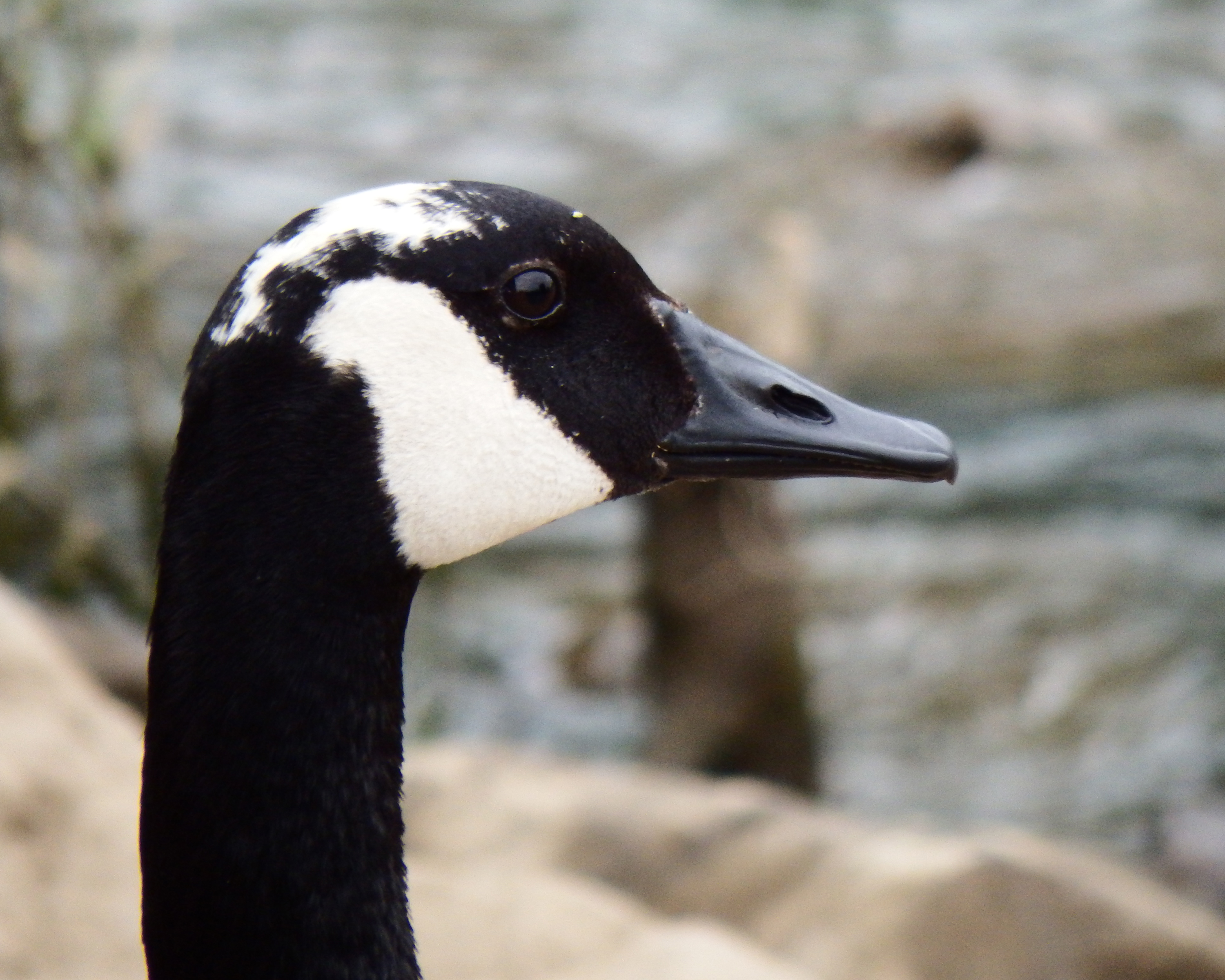
There were some geese families at the Tarentum Point Park, and one caught my eye due to the unusual markings on her head.  In researching this, it’s possible that at some point in her history, a Canada goose mated with a snow goose.  Interesting.


As we looked across the Allegheny River, I could see a large bird flying upstream, but it was too far away to photograph.  Of course I had to wonder if it was yet another Great Blue Heron, since that seemed to be the trip’s animal totem. 🙂

And as we’ve done when visiting other rivers (and oceans), we paused for a moment to “bless the Allegheny” and toss in a small quartz crystal….


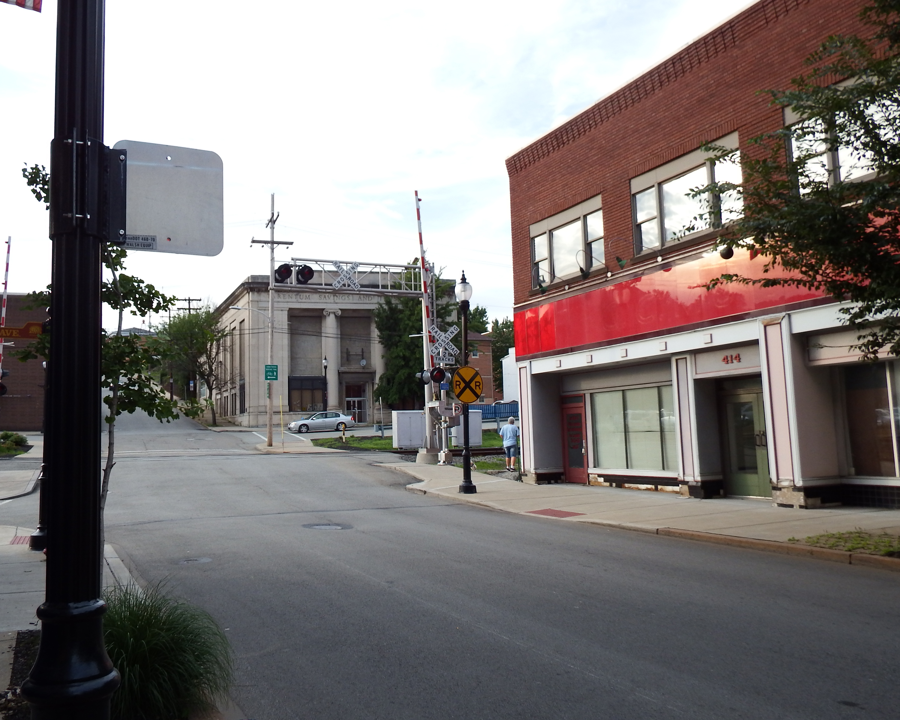
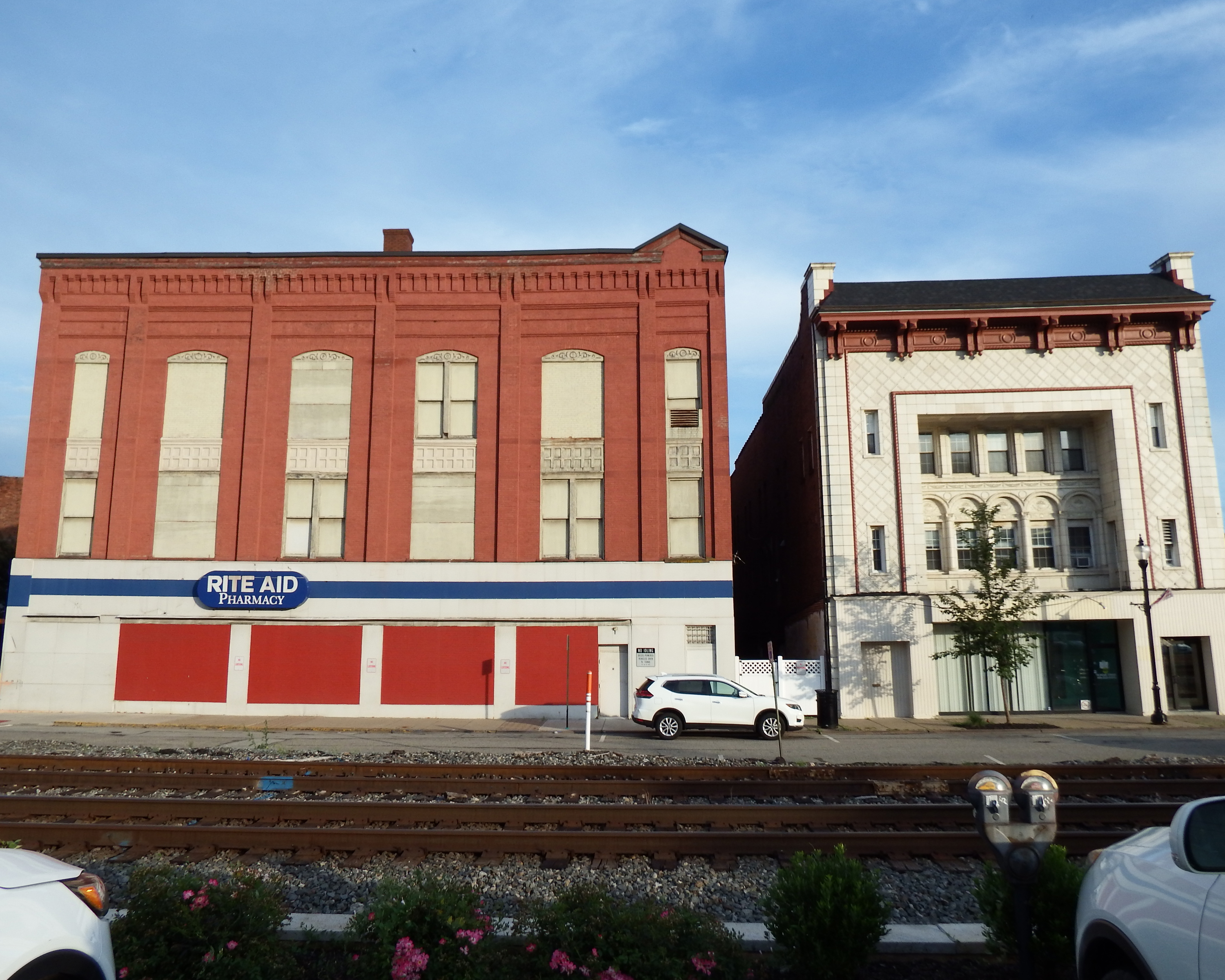
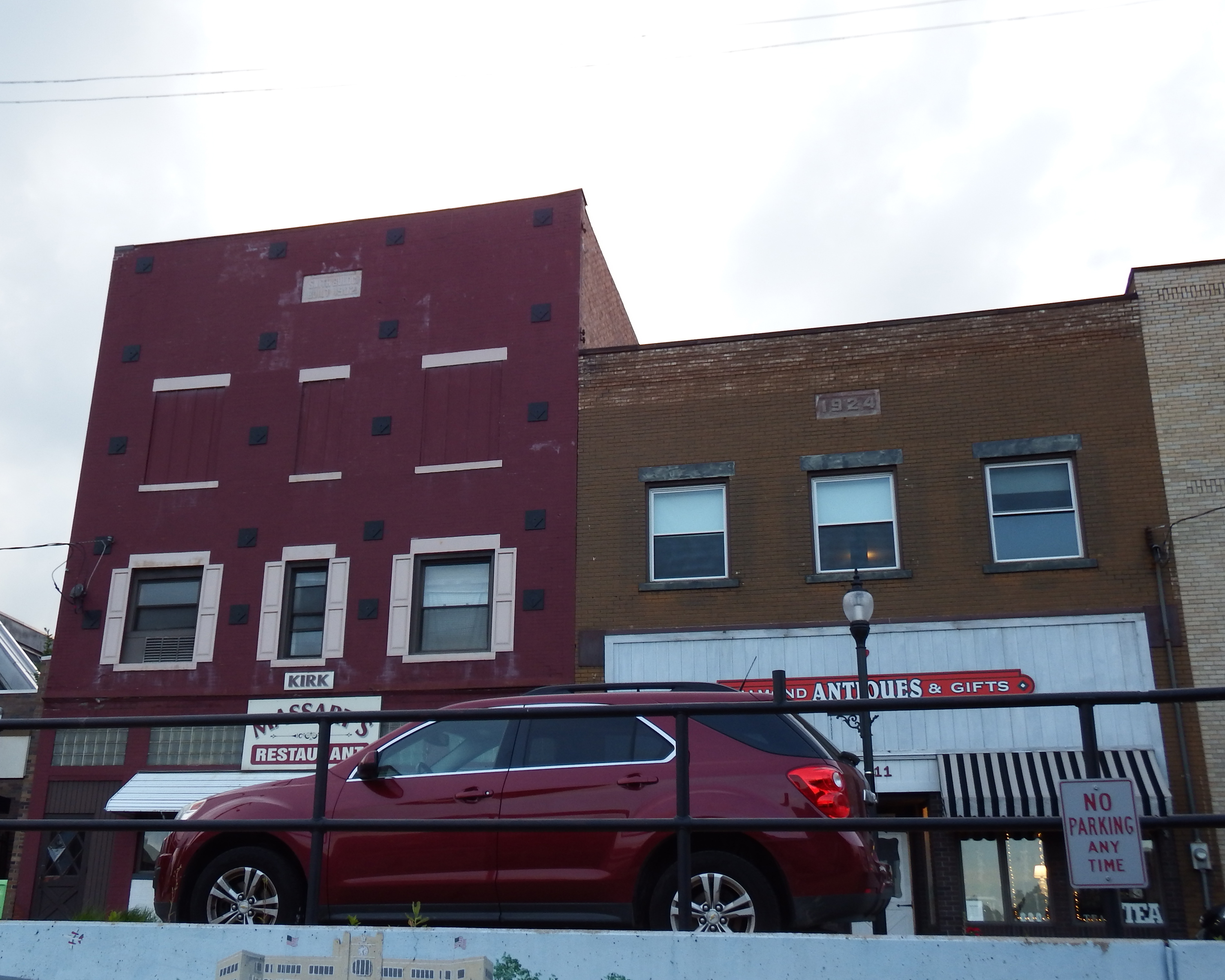
When we drove to the downtown area, I tried to see all of this through my grandmother Barrett’s eyes. For the first time, I realized how difficult it must have been for her to leave the town she’d grown up in, and to move to Indiana with her husband and three young children….

There’s a wonderful (closed) Facebook page called Tarentum and Surrounding Areas Pictures and Postcards, and from the pictures, I know this was once a thriving, bustling community, complete with shops, banks, and even an opera house!


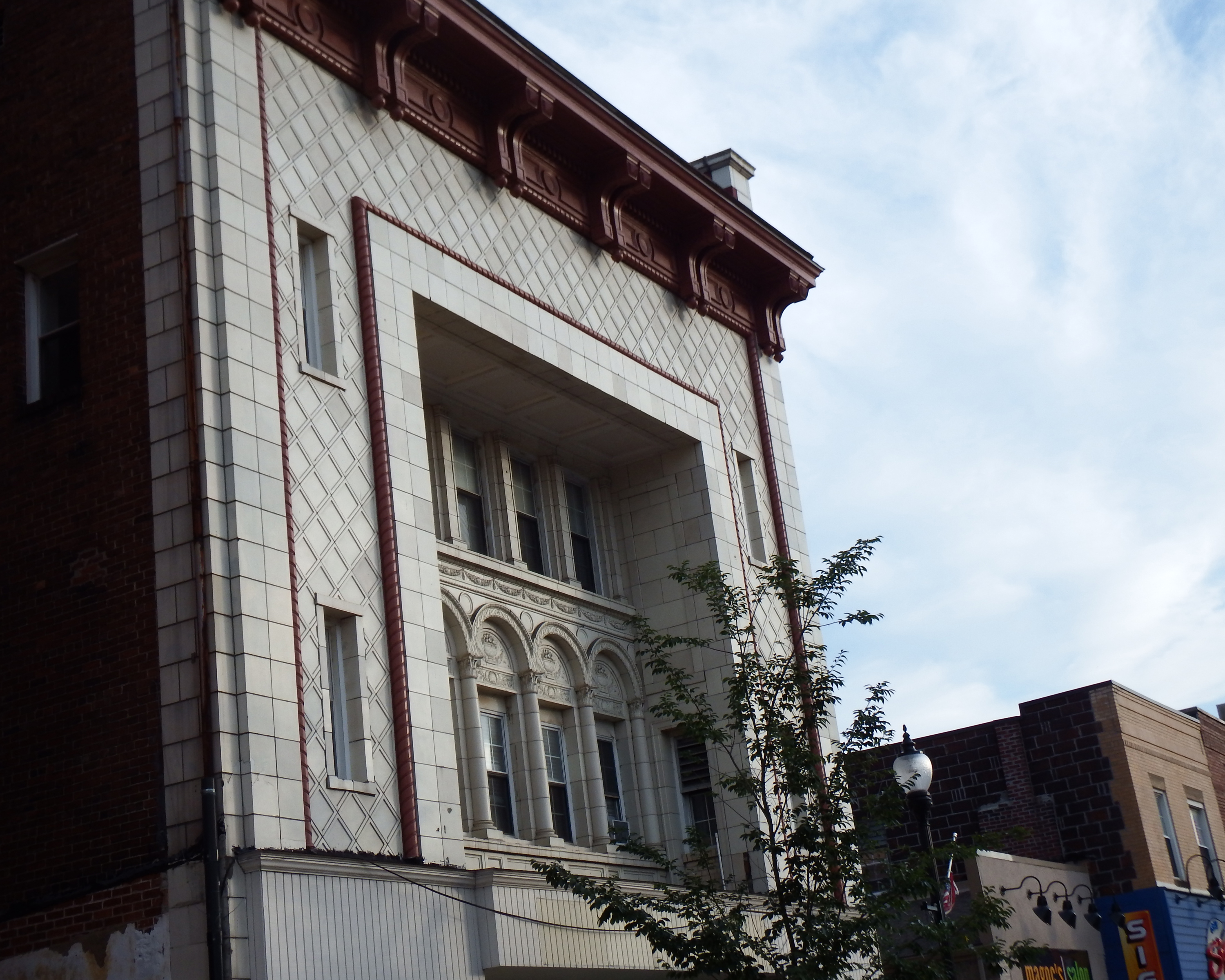
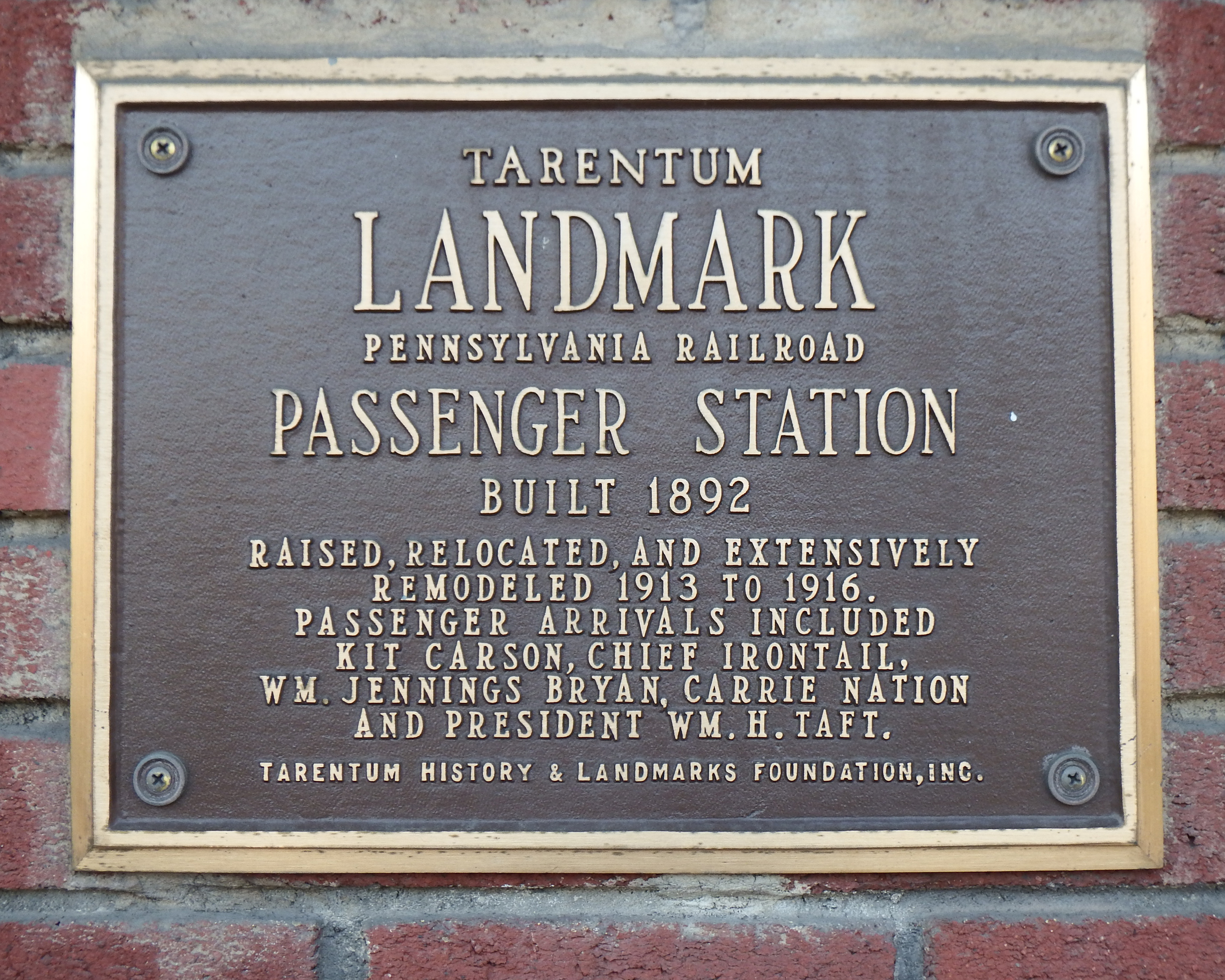
I was especially interested in the train station, as this was most likely the way my great-grandfather, John Victor Koontz, had arrived in Tarentum from Staunton, Virginia, and almost assuredly the way HIS father, my great-great grandfather, John Peter Koontz, had come to Tarentum from Staunton sometime between 1895 and 1905.  More on him in a bit….


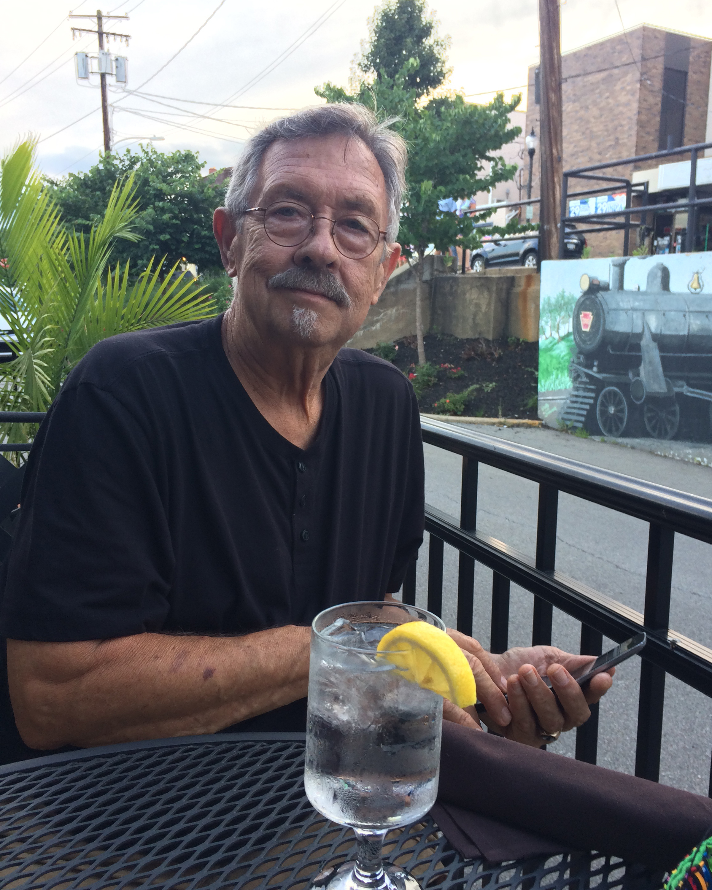
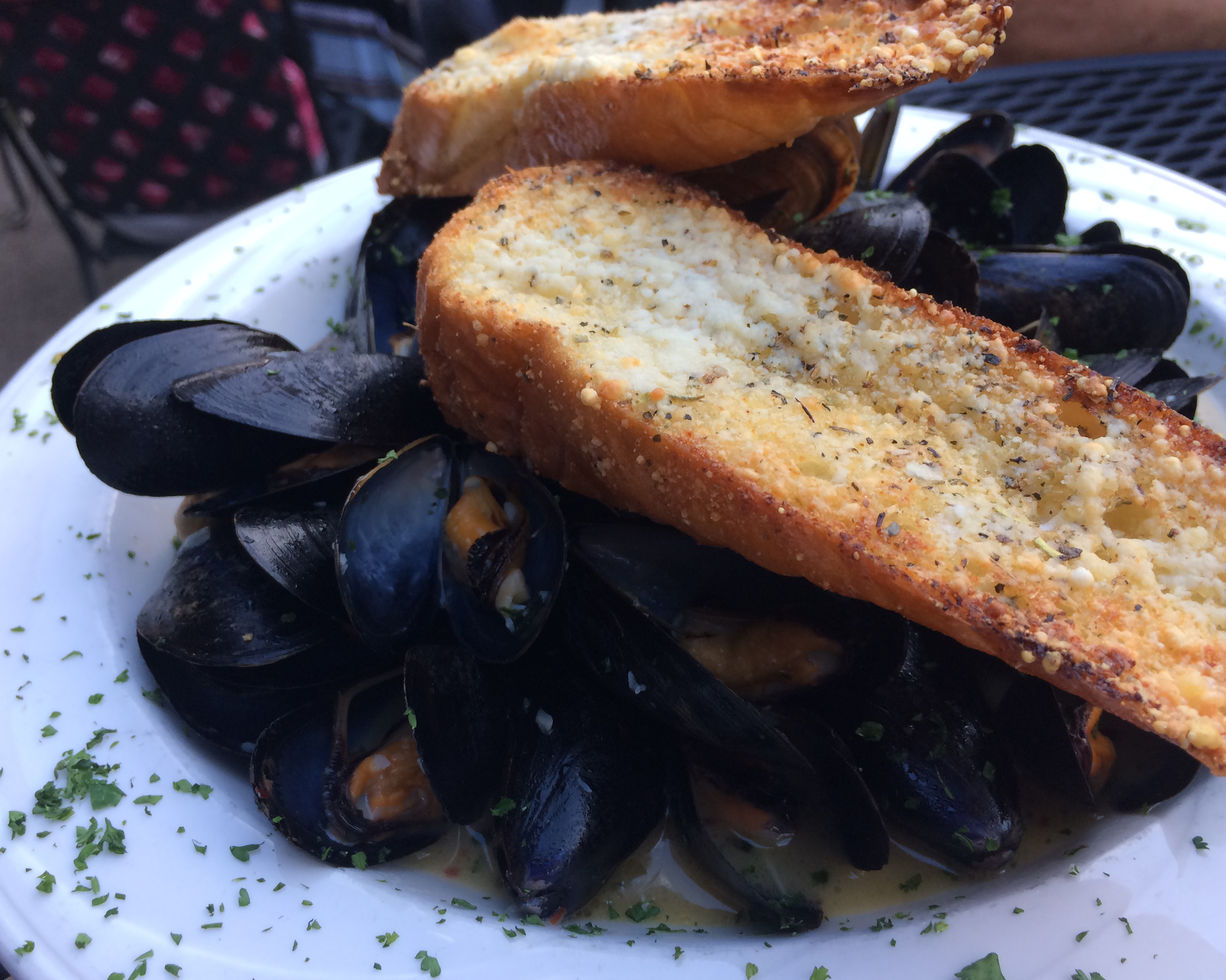
The train station is now a restaurant, J.G.’s Tarentum Station Grille, and while we weren’t really dressed for anywhere fancy, we discovered there was a more casual area out on the patio.  We ordered “Drunken Mussels” as an appetizer, and split an order of stuffed flounder.  Most excellent.


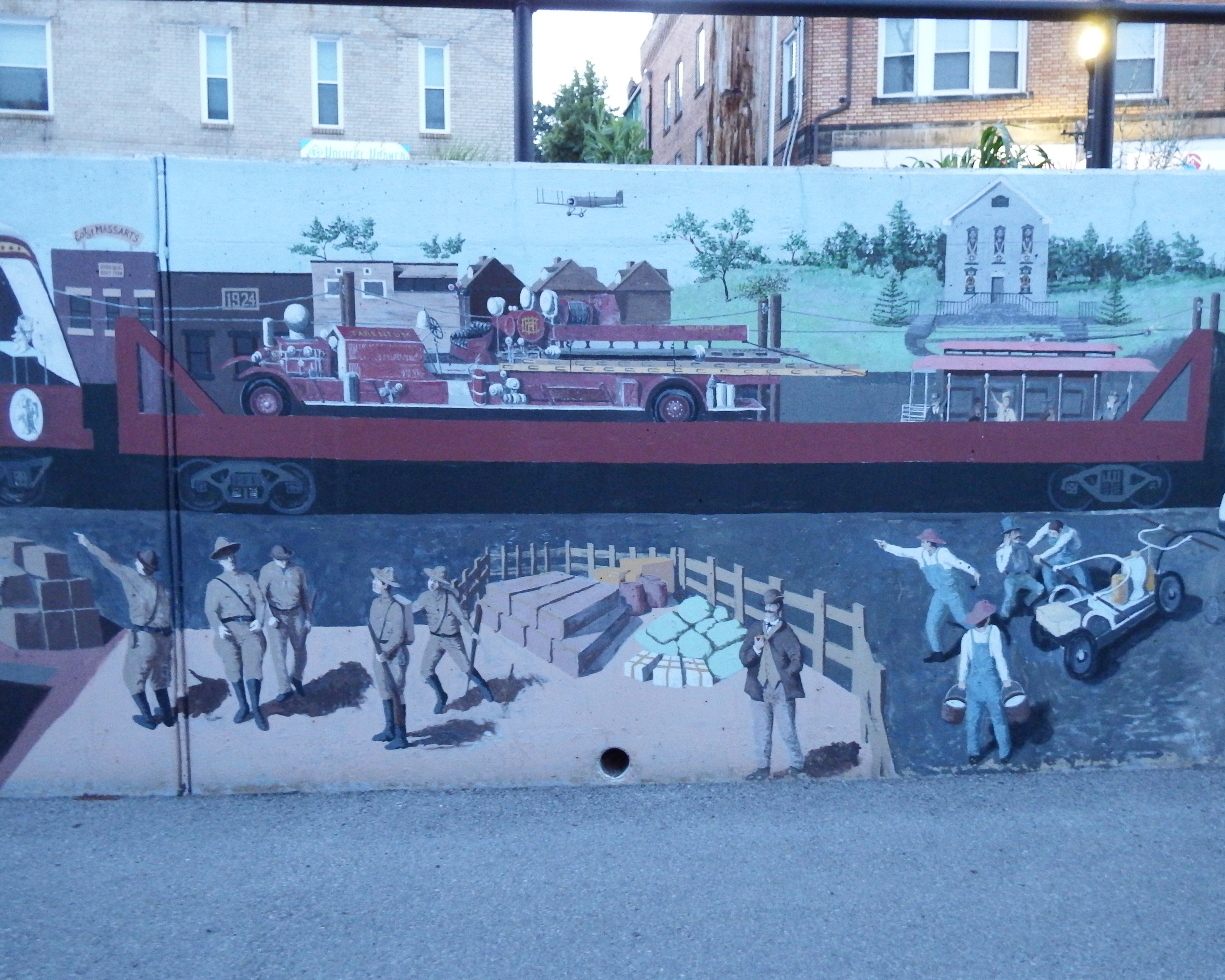
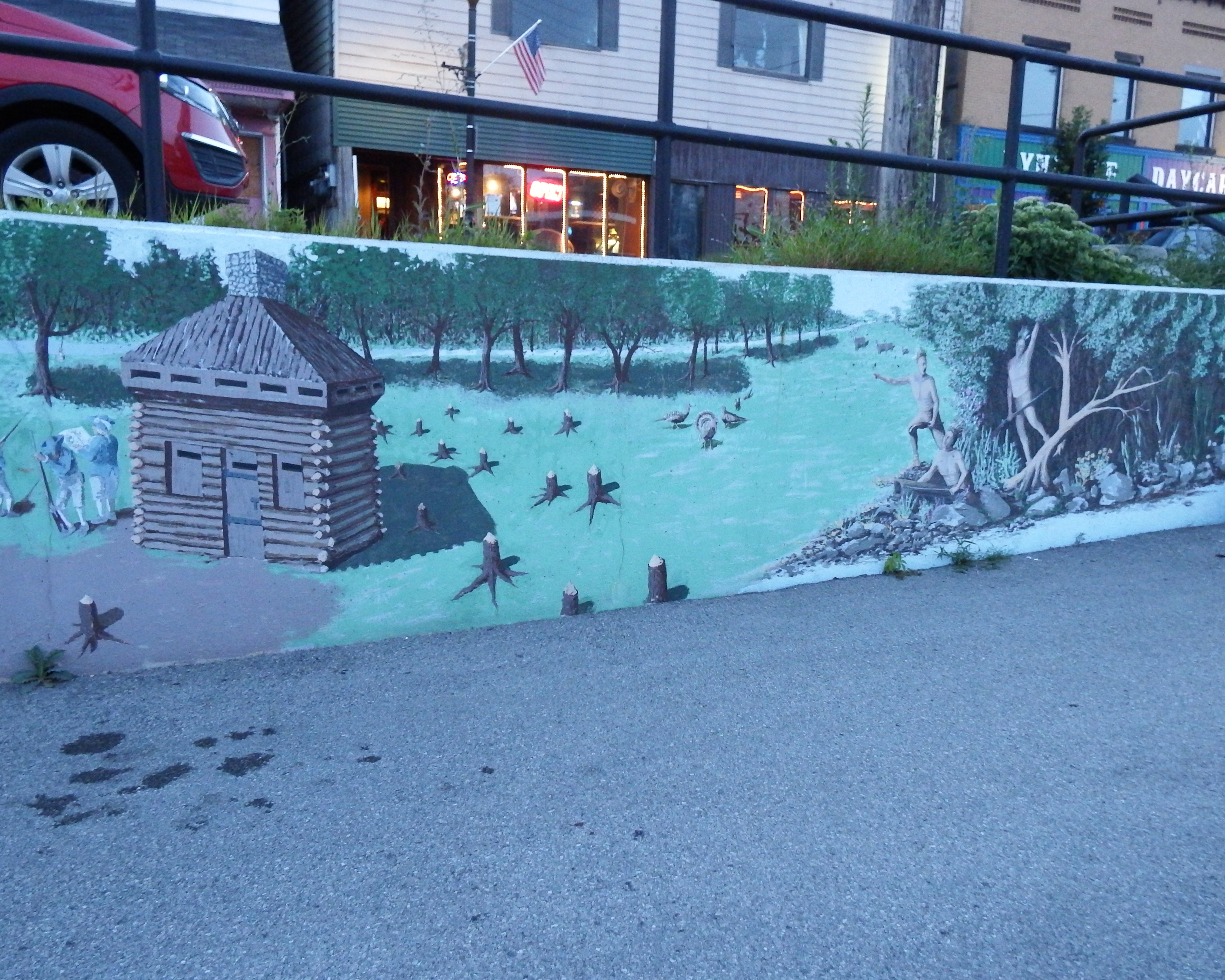
I was totally intrigued by the mural along the back of the restaurant, which portrays the history of the area.


According to the 1920 census, my grandmother Barrett worked as a “timekeeper” for the company that became known as “Alcoa.”   My grandfather Barrett began working at the same company when he was in his early teens, continued working there after he returned from his service in WWI, and later transferred to Indiana after a factory was established there.  My great-grandfather Koontz worked as an electrician at the Plate Glass company, which was one of three glass factories in Tarentum.  (A wonderful history of the Tarentum area may be found at tarentumboro.com.  Check it out!)


It was nearly dark when we left the restaurant and started driving back towards the motel.  As we drove through the little town of Springdale, we passed by what seemed to be a very popular frozen custard stand.  Since it was still open, we turned around and drove back to Glen’s Homemade Custard.  Turns out, my cousins who grew up in the area LOVE this place!  We certainly enjoyed it, too. 🙂


I thought about everything we’d seen and done in the short time we’d been in Tarentum, and how this trip was really about honoring my dad and his family’s history.  When we pulled into the motel parking lot, however, the coincidental nature of the name on this tour bus made me laugh.  No, Mama, I didn’t forget you! 😉

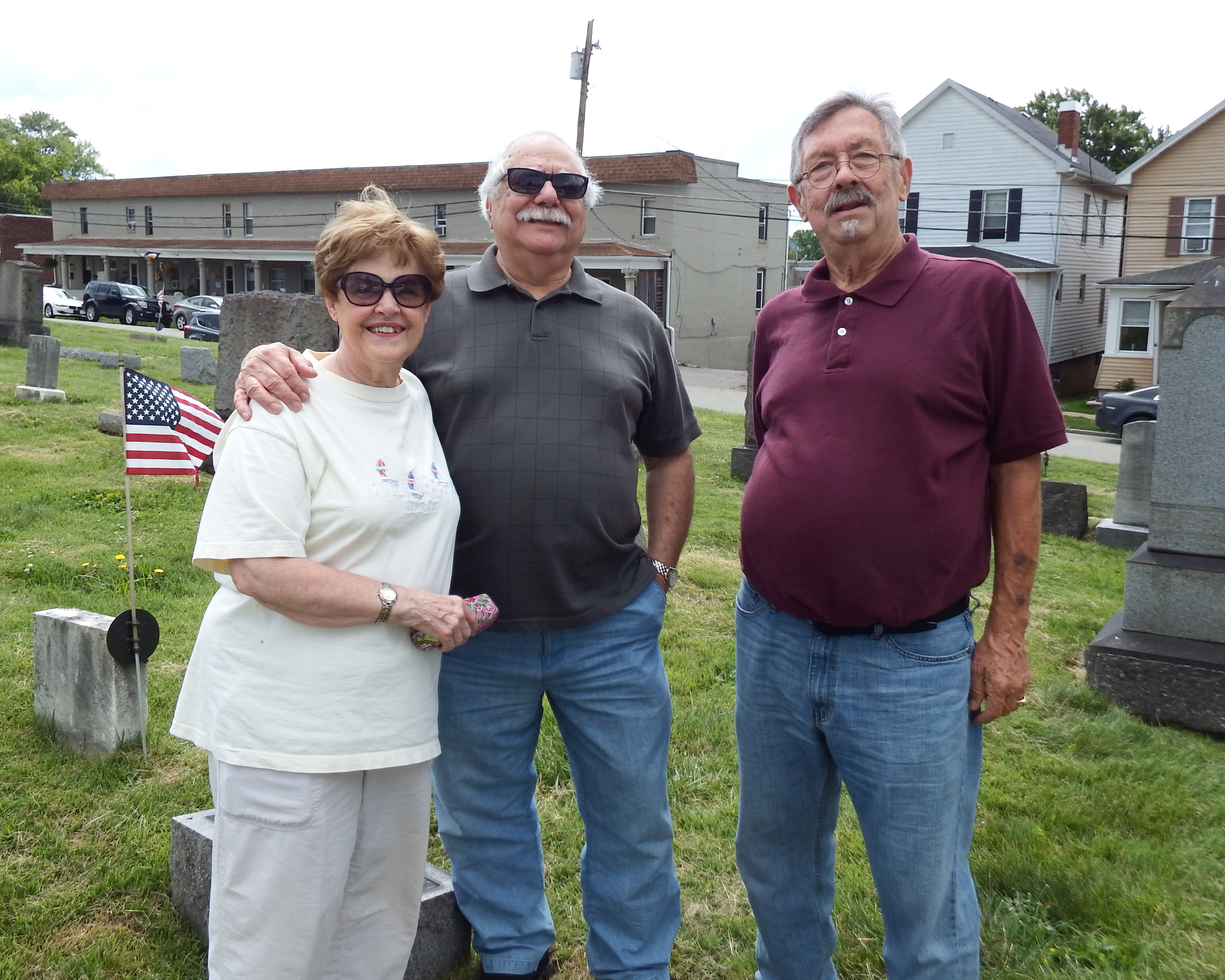
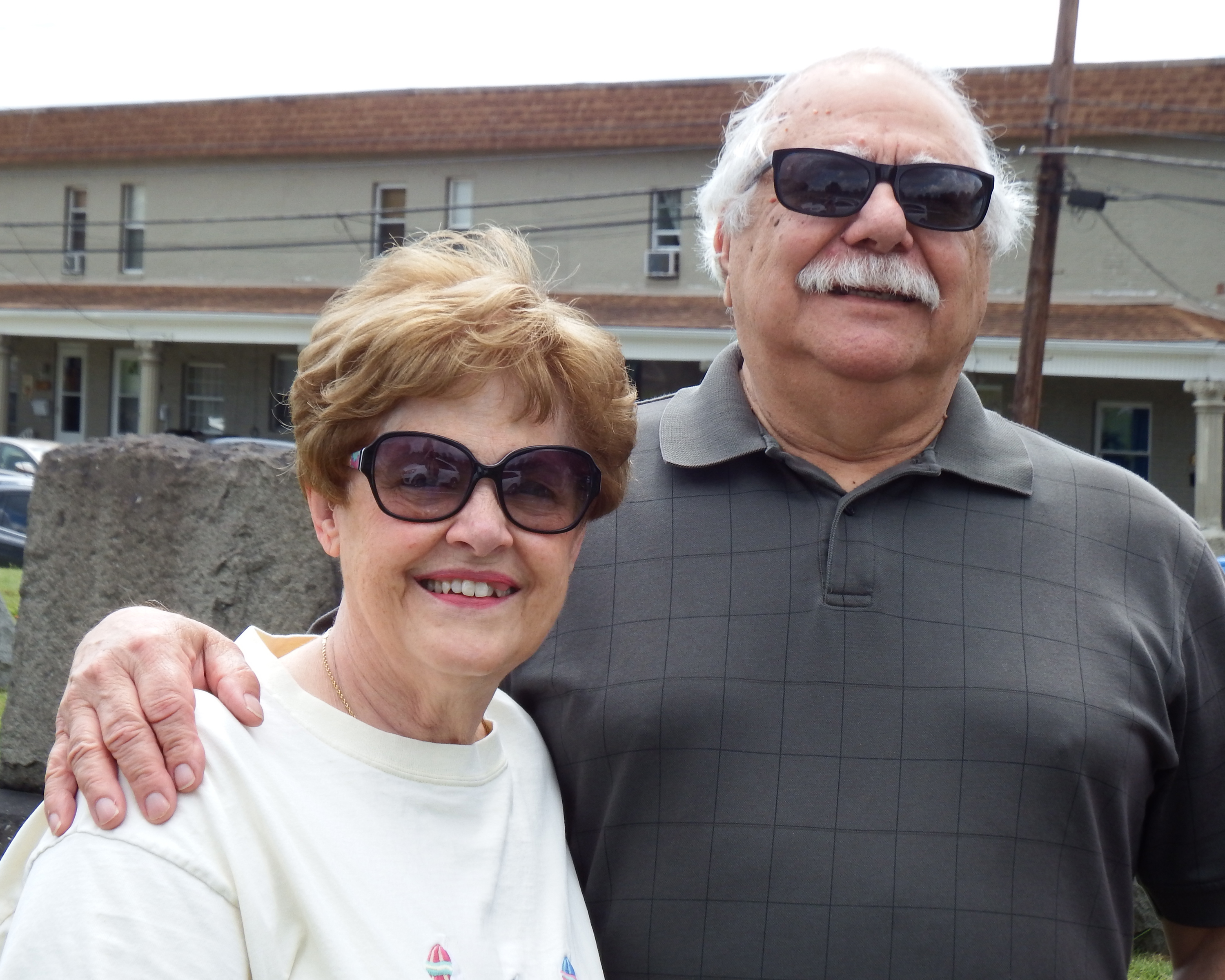
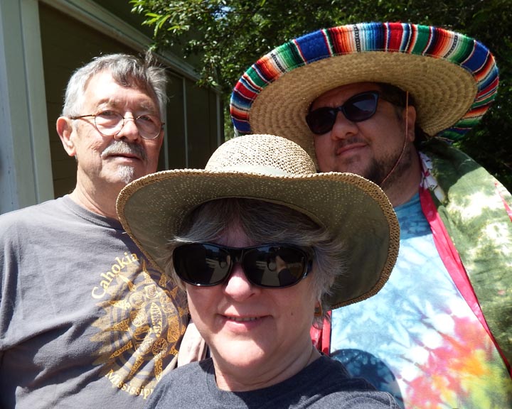
The next morning we drove back into Tarentum to meet my 2nd cousin and her husband for breakfast at the Cycle Diner.  Vivian and I have known each other for years through genealogy research and then Facebook, but this was the first chance we’d had to actually meet each other!

While waiting for them, I took more pictures of the downtown area–and totally forgot to photograph the actual diner.  (If you visit the link above, you can see pictures of it.)


It was so nice to meet Vivian and Frank, and there was much talking and sharing all around. <3

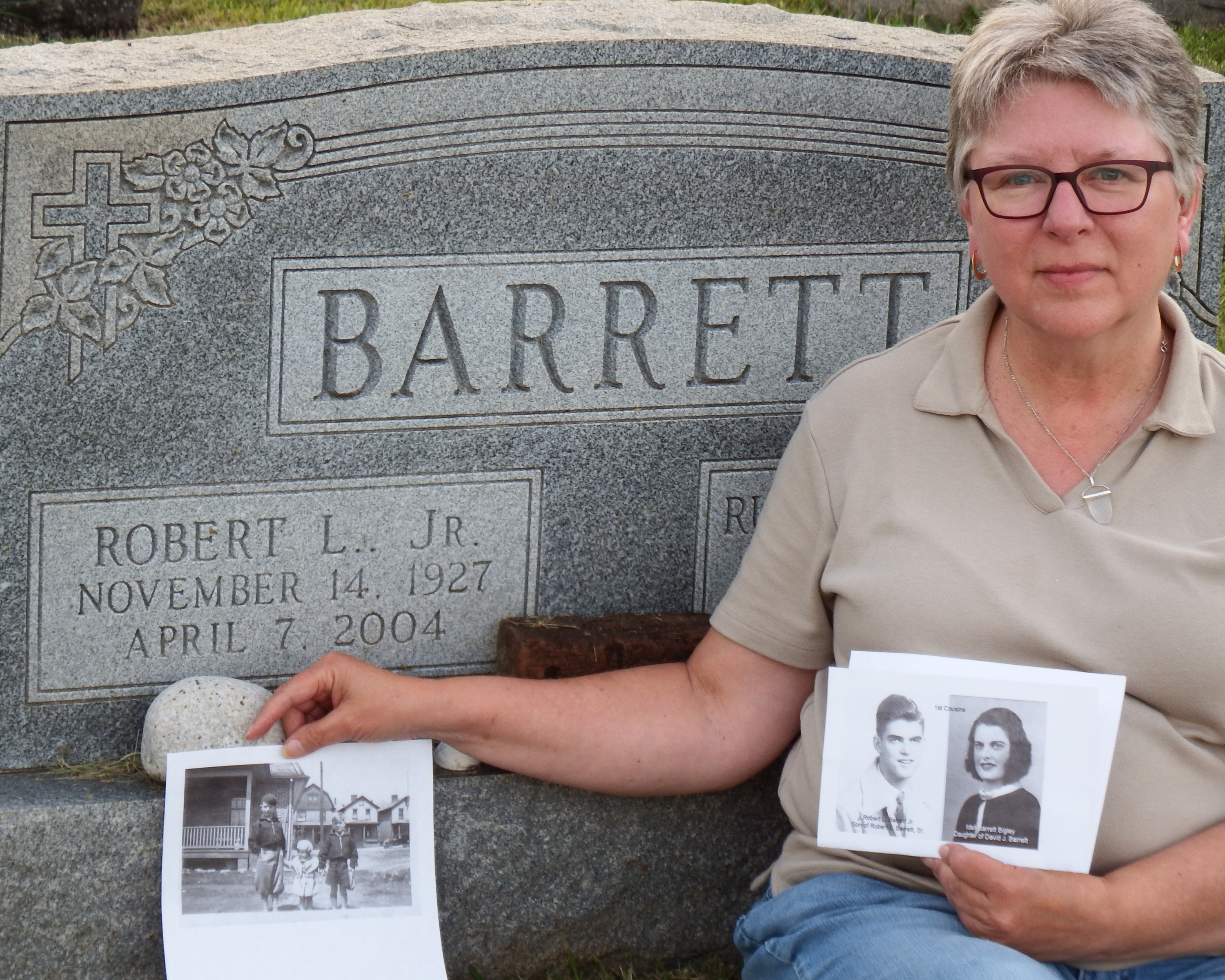
After breakfast, we all went out to Prospect Cemetery so Vivian could show me where our shared ancestor, John F. Barrett, was buried.  My dad and Vivian’s mom were first cousins.  The resemblance is striking!


Our great-grandfather, John F. Barrett, and his daughter, Beulah Barrett, are buried in Prospect Cemetery, but our great-grandmother Almira Jane Truitt Barrett was buried in a cemetery in the northern part of Armstrong County.  Sadly, we just didn’t have time to go there on this trip.


But what a nice morning!  Many, many thanks to my cousin and her husband for getting up early on a Saturday morning to make the 45-minute drive in to Tarentum to see us!

When Wayne and I left Prospect Cemetery, we started driving towards Leechburg, PA (northeast of Tarentum and on the east side of the Allegheny River), to Forks-Zion Cemetery in Armstrong County.  There I HOPED to find the grave of my great-great grandfather, John Peter Koontz.


Johann Peter Kunz was born near Flums, Switzerland in 1827.  He and his wife came to the United States in the early 1860s and settled in Staunton, Virginia.  There were other Koontz families living in the Shenandoah Valley at that time, and while he certainly must have had connections to them, I have not been able to link him to any of the other families.

John Peter Koontz, as he became known in the U.S., was a musician and a dance instructor in Switzerland, but by 1862, he was serving in the Confederate army with the Staunton Artillery–McClanahan’s Battery.  When he was paroled in April 1865, his discharge papers described him as being 44 years old, 5’6″, with a dark complexion, light hair, blue eyes. I’m reasonably sure that this is a picture of him, and the granddaughter of J.P. Koontz’s youngest daughter (who was named Amelia Rose), agrees.

I’ve found several newspaper articles from Staunton, Virginia from the late 1800s describing the wonderful music of “Professor Koontz’s String Orchestra” at various social and civic events. The Koontz family lived on West Beverly Street in Staunton, and J.P. Koontz continued to live there, even after his three children (and possibly his wife) had moved north.

At some point after 1895, John Peter Koontz moved to his son’s house in Tarentum.  My grandmother, Hazel Koontz Barrett, said she remembered hearing him play his violin on the front porch of their house when she was a young girl.

He died in Tarentum on July 15, 1905.   According to his obituary, he was buried in Zion Cemetery in Armstrong County, and his body was taken there by train.  (This was another reason I wanted to see and photograph Tarentum’s train station.)

Was “Zion cemetery” Forks-Zion?  Or was it Mt. Zion cemetery, which is also in Armstrong County, PA?  I’ve had to assume Forks-Zion, as this was where his son and daughter-in-law were later buried, and also because he is not on the Find a Grave website for Mt. Zion.  (A few years ago, I added his name to the Forks-Zion Cemetery on the Find a Grave website, just because it’s the most likely place that he was buried.)

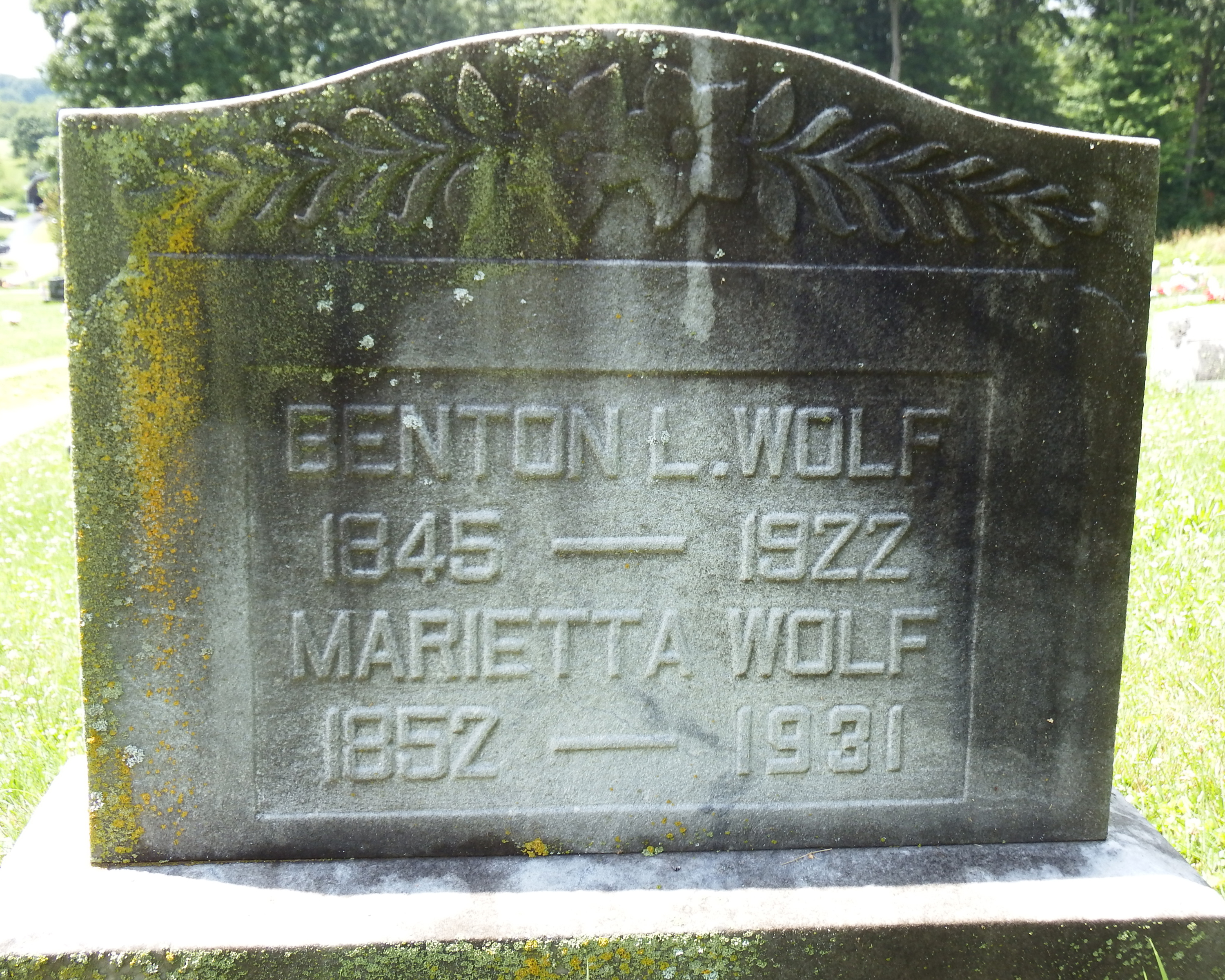
Pennsylvania didn’t start issuing death certificates until 1906, and this is unfortunate because his place of burial probably would have been listed on a death certificate.  In consulting with the cemetery managers at Forks-Zion, there really are no records to show exactly who is buried where in the cemetery!  From them I did learn that Benton L. Wolfe (Lottie’s adopted/step father) purchased a section of 8 grave sites in the late 1800s, but that’s the only information available.

While we were at Tarentum Point Park the evening before, Sandy, one of the managers of the Forks-Zion cemetery called to give me directions to the graves of Benton and Marietta Wolfe (where John V. Koontz, Lottie, and their son, Victor are also buried).  And then she surprised me by saying that there was another Koontz grave in the section!  It wasn’t the grave of John Peter Koontz, but the name on the marker appeared to be “Ester.”  She said it was too worn to read the rest, but it certainly made me curious.  Who was this?!

Once we arrived at Forks-Zion cemetery, Sandy’s directions made it easy to find the section where my ancestors were buried.  I said a quick, “Hello!” to everyone, then sat down in front of “Ester’s” gravestone.

First impression was that the spacing was off, and with a little cleaning, we were able to see that the name was LESTER–Lester W. Koontz.  (Aha!  Census recorded confirmed that this was a child of John Victor Koontz and Lottie May Erwin Wolfe, as she had 6 children, 5 of whom were living.)

With more cleaning, we were able to read the rest of the inscription:

LESTER W. KOONTZ, July 11. 96 – AUG. 4. 96, Aged 24 Days.  A bud of earth, a bloom of heaven.

I noticed that a butterfly had landed on the gravestone for John V. Koontz, and its shadow pointed directly to his name.  It stayed there while I took these pictures:


I quickly photographed the other graves in the section:


If Benton Wolfe (spelled WOLF on his gravemarker) had, indeed, purchased 8 grave sites, it was interesting to note that not all of the sites were occupied–and one of their sons was actually buried in a different section of the cemetery. There was no “depression” in the ground to indicate an unmarked grave, and so Wayne and I split up to start walking through the rest of the cemetery, searching for John Peter Koontz’s grave.

Some of the stones in the cemetery are so worn that they’re illegible, but despite spending a couple of hours looking, we were just were not able to find his grave.  Sad to be so close, but still have no answers….

I heard the rain before I saw it, and while I was checking an area near the front of the church, I was caught in a brief–but absolutely torrential–downpour.   It was time to go home….


I wanted to take a different route home, especially since radar showed heavy rain right along the Pennsylvania Turnpike.  Wayne rationalized that it would be better to stick to the interstate rather than traveling on smaller, more rural secondary roads.  (Last year, coming home from Florida, we got into some crazy situations on secondary roads during bad storms….)

We drove south from Leechburg on Rt. 66 along the Kiskiminetas River until the junction with I-76, and there, somewhat reluctantly, I pointed myself east on the toll road. I can’t say this was necessarily a bad decision, as the rain had expanded and would have made travel on the secondary roads difficult, too, but we encountered some really awful driving conditions almost the entire time we were on the Pennsylvania Turnpike, and continuing even after we were back on Rt. 522.  Very, very stressful!  No fun, at all!


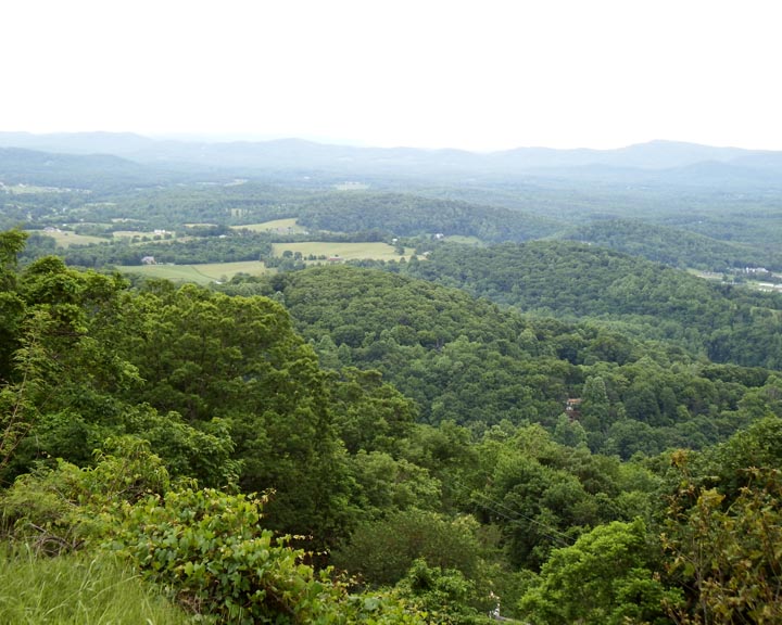
Just west of Winchester, however, the heavy, rain-soaked skies gave way to bright sunshine, and we were back in the beautiful Shenandoah Valley.


We stopped for a few minutes at the Rockfish Valley overlook on Rt. 250 east, and then I impulsively said I wanted to stop by the cemetery where my mom and dad are buried.  So for the second time that day, I was in a cemetery holding the picture of my dad and his first cousin–first at Prospect Cemetery in Tarentum, and then, about 9 hours later, at Hebron Cemetery in Nelson County, Virginia.


As we were leaving the cemetery, driving towards the front of the church, I glanced up,  and suddenly exclaimed, “HOLY SH*T!”

There in the sky above me, flying directly over the cemetery, were two Great Blue Herons!  I quickly scrambled out of the car and managed to get a couple of (blurry) pictures of them before they disappeared behind the trees….  Oddly, I found myself tearing up as I watched them fly over.  How “coincidental” to have seen this particular type of bird so many times during the trip.


We got home a little before 9:00 p.m., and out of curiosity, I looked up the symbolism of the Great Blue Heron.  This is what I found on one site:

If Heron is your Animal Totem

You love to explore various activities and dimensions of Earth life. On the surface, this may seem like a form of dabbling, but more than likely you are wonderfully successful at being a traditional ‘Jack of all trades’.

This ability enables you to follow their own path. Most people will never quite understand the way you live because on the surface it seems to be unstructured without stability or security to it. It is, though, just a matter of perspective. There is security underneath it all, for it gives you the ability to do a variety of tasks. If one way does not work, then another will. This is something you seem to inherently know.

You do not seem to need a lot of people in your life, nor do you feel pressured to keep up with the material world, or to be traditional in your life roles. You stand out in your uniqueness, and you know how to snatch and take advantage of things and events that the average person would not even bother with.

I don’t know if the Heron is necessarily my animal “totem,” but in many ways–given all of my many, many interests–this description is pretty accurate. And regardless of the symbolism, I have to wonder if these birds were somehow our “guardians” or cosmic “mile markers,” letting us know that where we were was where we needed to be.

I am disappointed that we were unable to locate and photograph the grave of my great-great grandfather; I was really quite sure that we would find it.  Wayne and I talk about completing “circles”–following events or situations through to a meaningful completion.  I had so hoped to complete John Peter Koontz’s “circle,” and to discover the final resting place of a man who came to this country from Switzerland, lived through the Civil War, made his home in Staunton, Virginia (which is less than 30 miles from where I’ve lived most of my life), raised three children, and then spent his last years in the Allegheny River town of Tarentum.

But I am also deeply thankful that we had the opportunity to make the trip, so that I could finally meet a “genealogy cousin,” see where my dad, aunts, uncles, grandparents, and great-grandparents lived, and explore a little bit more of my family’s history.

Posted in Adventures & Travels, Animals & Wildlife, Genealogy | Tagged , , , , , , , , , | 4 Comments

Virginia Beach – June 2017

We were so excited!  We were finally able to make camping reservations for two nights at First Landing State Park.  This is a place we’ve visited many, many times, and camping there has been a goal for the past couple of years.

As fate would have it, our plans had to change the day before our trip when we realized that we would not be able to tow our trailer to the beach with either of our vehicles (long, frustrating story).  We were still determined to get our ocean fix, however, so we booked a room (for just one night) at a motel we’ve stayed at before in Virginia Beach.

We left home around 9:30 a.m. on Wednesday, June 28th, and took the slower, more “scenic” route to Virginia Beach along Rt. 5, southeast of Richmond, VA.  This is an especially pretty drive in the Fall when all of the leaves are changing colors, but it’s a nice, low-stress/low-traffic route any time of the year.

One of the highlights of going this way is crossing the James River on a ferry near Jamestown.  Established in 1607, Jamestown was England’s first permanent colony in North America, and you can see replicas of the ships–as well as other parts of the settlement–from the ferry.


Two ferries run back and forth across this wide stretch of water, and as we drove onto the “Surry,” we could see the other ferry heading towards Jamestown.


Various types of sea birds hang out near the docks, and I can usually get some good pictures.  This time was no exception:


It takes 15-20 minutes to cross the James River, and some of the gulls get their exercise by following behind the ferries, hoping to catch fish that are churned up by the propellers.


After crossing the James River, the rest of the drive to Virginia Beach winds through Surry, Smithfield, and other small towns.   All in all, this route adds about 30 miles and almost an extra two hours to the trip, but sometimes the slow pace and extra travel time beats all the congestion and traffic in the Hampton Roads area.

We arrived at our motel just before the 3:00 p.m. check-in.  Located in Virginia Beach Town Center–10 miles from the oceanfront–we’ve always found it to be clean and comfortable.  The biggest draw is that it makes a summer trip to the beach more affordable, since a similar room right on the beach during this time of year costs 3x as much!

We quickly changed clothes and headed to the beach.  And as we always do when we’re by the ocean, we let the tide wash away TIME–at least for a little while…..


Absolutely blissed out!  It was so nice to just relax and focus on the sound of the waves….


The weather was perfect–just about 80 degrees with a nice breeze.  We could have stayed out there for hours….

That evening we went to one of our favorite seafood restaurants for dinner.  All-you-can-eat crab legs?  Yes, please!


After dinner, it was back to the oceanfront to walk off our meal on the Virginia Beach boardwalk.  It was surprisingly cool, and we were glad we’d brought our sweatshirts!


The next morning, we checked out of the motel and drove to the campground at First Landing State Park.  We knew a friend was camping there, but we had no idea which site he was in.  We cruised through, looking at all the campsites, RVs, trailers, and tents (maybe some day we’ll camp there!), and as we drove back by the entrance of the park towards the visitors center, we saw our friend driving in!  The timing was so coincidental; 15-seconds either way and we would have missed him!  He was more than a little surprised to see us. 😉

This state park has over a mile of beach on the Chesapeake Bay.  The gentle waves make it a perfect spot for families with young children, and the water is much warmer than the ocean at this time of year.  I wandered around taking pictures while the guys got in the water.


The 60x zoom on my camera allowed me to take some surprising clear pictures of the Chesapeake Bay Bridge-Tunnel, which you can see from the park.


We spent an hour or so on the beach, then Jim headed back to his campsite to pack up.   Our next stop was the section of First Landing State Park that’s accessed from 64th Street.

We always love walking along this pretty trail, and you never know what you’ll see.   Sometimes there are lots of birds (gulls, herons, ospreys, etc.), but we saw very few this time.  We usually visit in the early morning or late evening, so perhaps the birds are less active during the middle of the day.  Regardless of the reason, it was still an enjoyable walk. 🙂


It was low tide, and we watched a whole army of tiny crabs scuttling across the mud:


As usual, we stayed a bit longer than we’d planned to, so after driving west through Ocean View all the way to the end of Willoughby Spit, we decided to take the “faster” route home by getting on I-64 West.  Didn’t happen….  First surprise was that the entrance ramp at the end of Rt. 168 was closed, and the second surprise was seeing a long–literally miles-long–backup at the east entrance to the tunnel.  Not good….

We thought that maybe the tunnel on Rt. 664 would be less congested, so we wove our way south through Norfolk to get there.

We went through one tunnel….


…and just before heading into the second tunnel, I realized that we were crossing the James River!  Again!  As many places along the James that we’ve visited, I’d never realized that it empties into the Chesapeake Bay right at Hampton Roads!


As it turned out, all of our running around with the intention of having a quicker trip home didn’t save any time or any miles; in fact, it was almost exactly the same distance as our trip the day before on Rt. 5.  And as we looked at the 3-mile-long backup of cars trying to get into the Hampton Roads area from the west, we started to wonder if we’d really want to tow our trailer into this mess, regardless of the route.  Dunno….

There was a lot of traffic and non-stop construction from Hampton Roads to west of Williamsburg on I-64.  Finally (just west of Richmond), things settled down and the rest of the drive home was much easier.

We’re so glad we had the opportunity to get our ocean fix at Virginia Beach this summer–even if just for one night!–but it’s always nice to come home to our mountains, too. 🙂


Posted in Adventures & Travels, Animals & Wildlife | Tagged , , , , , , | 2 Comments

Appomattox, VA & Holliday Lake State Park – June 21, 2017

Wayne and I had been trying to find a weekday to do some genealogy research in Appomattox, and finally we were able to make the trip on the Solstice.  As with most of our travels, the journey can be as interesting as the destination, and this trip was no exception.  (To better see our route, you can click this link for an interactive map, and you can also click any picture to enlarge it.)

The first bit of beauty on the drive was a field full of chicory in bloom on Plank Road, just west of Rt. 29.  These beautiful blue flowers were everywhere!


The mountains kept us company on the way down Rt. 29 South, and we crossed the James River (for the first time) just before getting on Rt. 460 East near Lynchburg.


Our primary destination was the court house at Appomattox–not the famous, historical court house east of the town, but the one where Appomattox County deeds, wills, and marriage records are kept.

Wayne’s great-grandmother, Laura Bell Ferguson Wright (1861-1914), lived in Appomattox all of her life.  In the e-book, Appomattox Virginia Heritage, it’s said that Laura and her children lived in the McLean House–the house where Lee surrendered to Grant in April 1865 during America’s Civil War.  While we cannot prove this (and facts about the history of the McLean House seem to disprove it), we do know that she lived in the community of “Clover Hill,” which is now the site of the Appomattox Court House National Historical Park.  (More information about Appomattox County may be found here and here.)

We literally spent hours at the court house, and over the next few weeks I will be transcribing several deeds that we found.  These documents should complement our previous research at the Virginia State Library in Richmond, Virginia, and from online sources.


We also tried to learn more about Laura’s husband, Christopher/Richard Wright.  While I do not think that Laura had two Wright husbands, the name Christopher Wright appears in some early documents, and Richard/Dick Wright in later documents.  Given that a fire destroyed most of the federal census records from 1890, AND given that many early records from Appomattox County were lost when the old court house burned in 1892, we may never be able to get a clear, accurate history of this Wright family line….

Laura’s husband, Richard Wright, died in 1894 when his children were quite young. One of the “six little children” left by his death was Wayne’s grandfather, Willie T. Wright (1888-1924).

Unfortunately, Willie T. Wright also died young, leaving a wife and young children.  His widow, Annie Carter Wright (1894-1977), remarried about a year after his death, but she was buried beside her first husband and her parents in Liberty Baptist Church Cemetery in Appomattox.  We stopped by their graves on our way out of town.

Just beyond the Appomattox Court House National Historical Park (which we did not visit on this trip) is Clover Hill Village, a “living history” center established by the Appomattox County Historical Society in 1991.  Unfortunately, the buildings are only open Friday through Sunday and no one was there, but we were able to wander around the grounds and look at the various structures that have been moved to the site.

Continuing east on Rt. 24, our next stop was at the New Hope Baptist Church near the community of Vera, Virginia.  Laura Wright was a member of this church, and while she was not buried there, her younger sister, Joe Ella Ferguson Harris, was.

In some of the deeds we found at the court house, we discovered that Laura Wright’s sons owned a 140-acre farm that was described as being 7 miles east of the old Appomattox Court House and approximately 2.5 miles away from Hollywood Baptist Church.  Almost exactly 7 miles east of the National Historical Park on Rt. 24, we saw a sign for the church,  stating that Hollywood Baptist was 2.7 miles down Rt. 618.  This farm was at the intersection, and while we can’t say, for sure, that this was the Wright property, it certainly seems likely. (Images are from Google Maps.)


We continued to drive east on Rt. 24, and when we saw the sign for Holliday Lake State Park (Rt. 626), we impulsively decided to check it out, crossing our fingers as we made the turn.

In late February 2016, we’d set out for a day trip to this park, but just before we got there we found an injured hawk in the middle of the road.  I’d cautiously wrapped it up in Wayne’s sweatshirt jacket, and then two rangers at the entrance to the park helped us put the hawk in a large box.  They also called the Wildlife Center of Virginia for us since we had no cell phone service.  You can read more of the story here.

This time we encountered no injured hawks or other wildlife, and we were finally able to explore this beautiful state park.  We were very impressed with the campgrounds, and we made note of our favorite sites, for possible future reference.

We were even more impressed with the lake, which was much, much larger than we’d anticipated.


We ordered sandwiches from a concession stand near the beach, and while waiting for our order, we noticed two park rangers in the parking area.  Wayne encouraged me to walk over to see if they were the rangers who’d helped us with the hawk, and they were!  Wayne snapped a picture of us as we were chatting.

We thoroughly enjoyed our visit to Holliday Lake State Park, and like other Virginia parks that we’ve visited, we can say that this one is also a little “gem.”


We made our way back to Rt. 24, and then turned north on Watt Abbitt Road (Rt. 654), which wound its way towards Rt. 60 West.  This allowed us to cross the James River again, this time near Gladstone, VA.


As we’ve done before, we took a shortcut from Rt. 60 to Rt. 29 via Tye River Road (Rt. 657).  Truthfully, it’s not much of a “shortcut,” but the mountain views are worth the extra travel time.


We wondered what happens to the animals that are displaced when huge tracts of trees are cut down (as they are in this area with all the commercial logging that goes on), but I guess some animals adapt well to the changes.  This Red-Shouldered hawk was too far away to get a clear picture, but from its vantage point on the top of a dead tree, it was probably able to have a successful hunt.  When I tried to re-focus on the hawk, I inadvertently zoomed in on the wrong dead tree, and I didn’t know I’d gotten a picture of a woodpecker until I downloaded my pictures!


There are such pretty places along this road…


We finally made it back to Rt. 29 and started the drive north towards home.  All in all, it was a productive and beautiful day–and a great way to spend the longest day of 2017.  🙂


Posted in Adventures & Travels, Animals & Wildlife, Genealogy | Tagged , , , , | Comments Off on Appomattox, VA & Holliday Lake State Park – June 21, 2017

Campgrounds and Coincidences – May 29, 2017

We thought about working in the yard; we really did!  But with a basically sunny day–after so many rainy weekends–we decided to go for a drive, instead.

We headed west on Rt. 250 and got on the Blue Ridge Parkway at the top of Afton Mountain.  We’re within 10 miles of the north end of this 470-mile road along the crest of the Blue Ridge Mountains, and we go often!

We stopped at the first overlook on the Parkway to eat a quick breakfast that we’d picked up at a convenience store on the way.  We then continued south for a few more miles and turned right onto Reids Gap Road.

This narrow, curvy road offers some amazing views as it winds its way down the mountain to the Shenandoah Valley. We stopped to take this picture, and the ridges you see in the distance are the Allegheny Mountains, which are on the other side of the valley. (You can click on all of the pictures in this post for a larger view.)

When we got to the bottom, we turned left on Love Road (Rt. 814) when we actually should have turned right.  Whoops!  Oh well, when we reached the Blue Ridge Parkway again (south of where we’d turned onto Reids Gap Road), we simply turned around and drove back on Rt. 814 to Rt. 664, and then on to Sherando Lake and Campground.

Sherando Lake is truly a special place.  We camped there for the first time last September (pics from our camping trip are here), and we hope to camp there again sometime this summer.

Driving in, I wondered if I’d see my cousin, Mary, and her husband.  Sherando is their favorite campground, but when we drove through, checking all of the sites, we didn’t see them or their trailer.  I was surprised to see that a majority of the sites in the campground were vacant, but given the time of day, I guess most Memorial Day weekend campers had already checked out and headed home.

The lack of campers in the campgrounds, however, was more than offset by the number of people at the lake and in the picnic areas! Since parking spaces were limited in the beach area (and we didn’t plan to swim anyhow), we drove up to the dam above the lower lake.  You can see the beach at the far end.

We saw a large bird flying high above the lake, and it appeared to be an osprey, even though I couldn’t get a clear shot.  Just recently, I’ve seen a few ospreys at other local lakes, so I guess it’s possible….

After leaving Sherando Lake, we headed north towards Lyndhurst, then turned left on Howardsville Turnpike (Rt. 610) towards Stuarts Draft.  This is another pretty valley drive, and our next stop was at Shenandoah Acres Family Campground.

I went to this lake with my parents when I was a kid, and when my sons were young, we spent a fun day there in the 1990s with some family friends.  In 2004, however, the lake was drained and the property was basically abandoned–for years.  Now, with new ownership and management, Shenandoah Acres is thriving again!  The campground boasts close to 300 sites, and we enjoyed driving around, looking at all of the different types of trailers and RVs.  Our favorite sites were in “The Loop.”

After touring the campground (our second of the day!), we drove towards The Cheese Shop, which is also in Stuarts Draft.  Wayne has been there many times, but this was the first time for me, and I was so impressed with all of the spices, herbs, and non-GMO offerings they have.

We bought an assortment of things–including some cheese–and as we walked out to the car, I had a nice episode of “coincidence”:  While I hadn’t seen the cousin I’d been thinking about at the campground, my cousin’s daughter, son-in-law, and grandchildren had just pulled in!  We had a nice, but brief, visit in the parking lot. 🙂

Since it seemed that “campgrounds” had become the day’s theme, we decided to check out yet another one near Staunton, VA.  We took scenic backroads from the Cheese Shop to Rt. 11.

The Staunton/Walnut Hills KOA is a relatively small campground off Rt. 11 south of Staunton.  A couple of friends who’ve stayed there had told me about the ducks that hang out near the lake, and sure enough, there were ducks everywhere. We especially liked sites 26-33 along the lake.

So after touring these three campgrounds (Sherando, Shenandoah Acres, and Walnut Hills), we talked about the things we liked about each one and where we’d like to try to go next with our trailer.  Sherando is still probably top on our list, but I think we’d enjoy Shenandoah Acres, too.

As we started for home on Rt. 250, Wayne asked if I’d like to stop at the overlook on Afton Mountain.  This is another favorite spot, which offers beautiful views of the Rockfish Valley.


There was a gorgeous Airstream trailer parked at the overlook, towed by a Jeep Grand Cherokee.

Very, very nice set up….  Yeah, a girl can dream….

When I looked at the sign on the back window of the trailer, however, I had a flash of “alternate reality” or whatever!  We’d been looking at campgrounds and trailers all day, and suddenly there “we” were!  WOW!

The trailer’s door was open and a woman was reading, sitting on a couch across from the door, so as Wayne walked by, he said hello, and the three of us ended up talking for a few minutes. Turns out her first name is Barrett, and she laughed when I told her my last name is Barrett–and that I’m an art teacher.  She said she’d be spending the next three days doing en plein air painting, and I told her that our school has offered en plein air painting events for local artists.  Small, funny world. 🙂

After we got home, I looked up her website, and it’s most impressive.  Check it out: http://barrettedwards.com/about

Pretty darned cool coincidental ending to our campground-themed day!

Here’s a map showing our route today, and you can click here for an interactive map:

Posted in Adventures & Travels | Tagged , , , | Comments Off on Campgrounds and Coincidences – May 29, 2017